Star Date 3 September 2019 Tuesday
Captain's Log
Hard to say happy Tuesday in light of Dorian.
The historical peak week of the hurricane season (Sept 10th) is here and living up to expectations. CLICK ON IMAGES FOR LARGER VIEW.
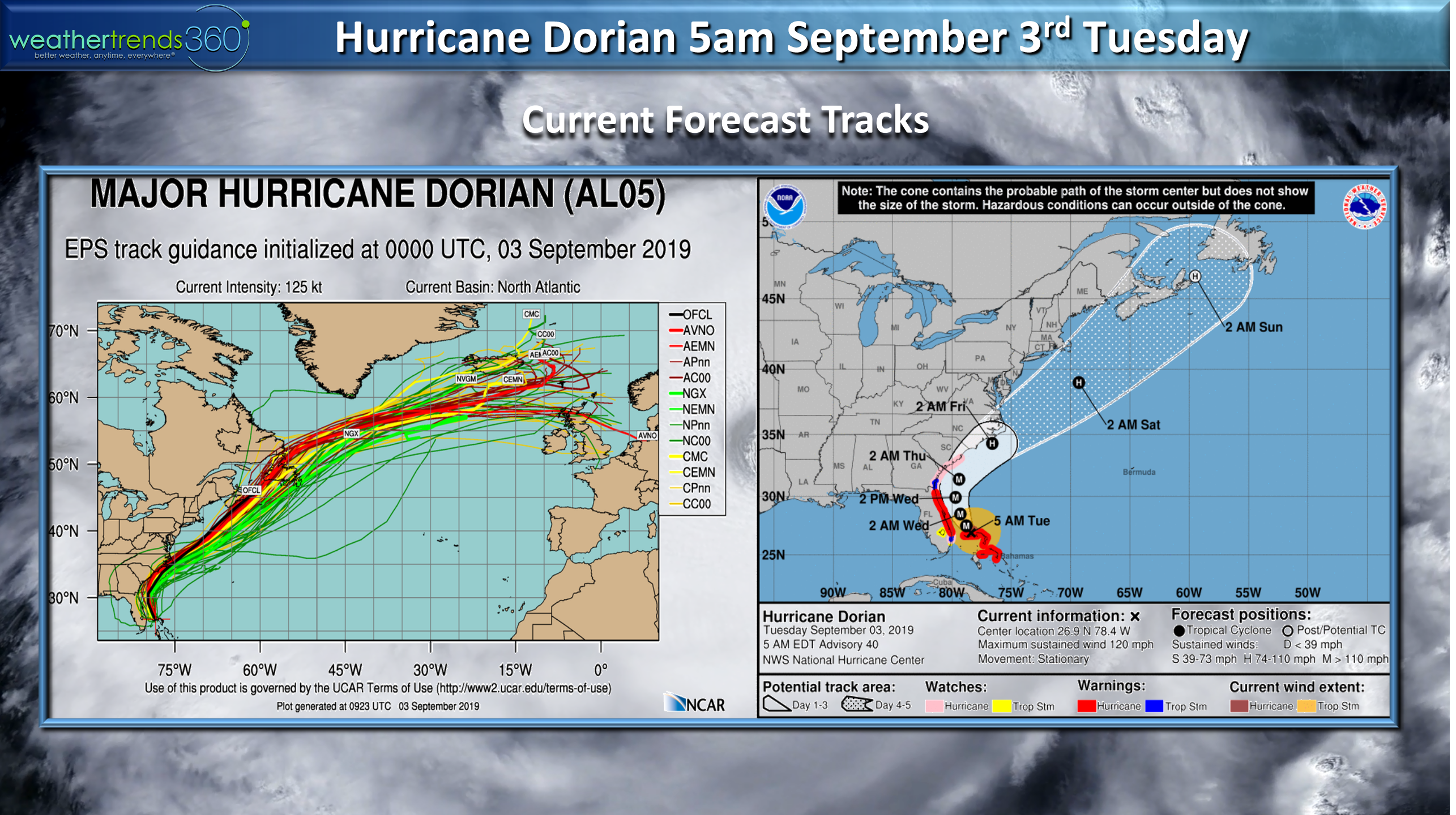
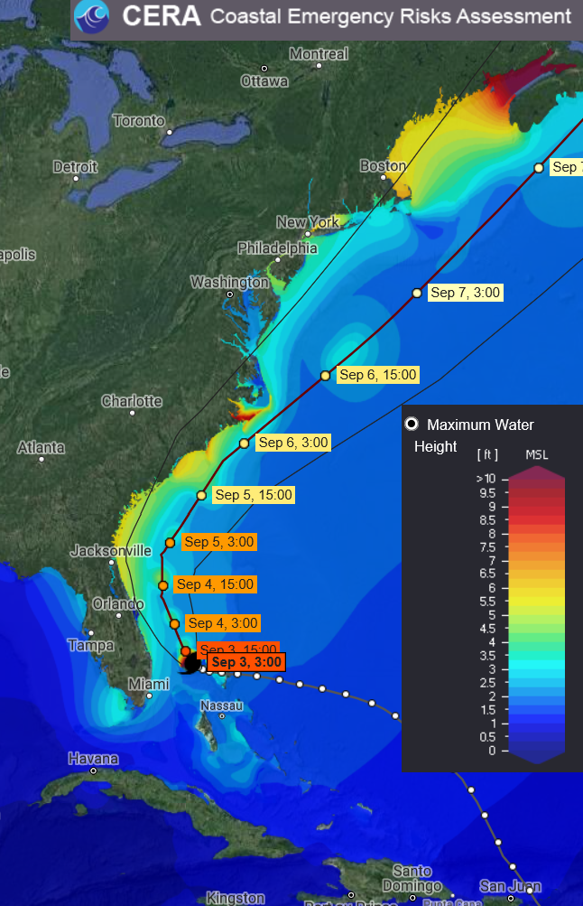
It's a close call but hopefully Dorian's right front quadrant eye wall never makes U.S. landfall...it will be close for the outer banks of North Carolina Thursday night into Friday am. The damage in the right front quadrant is the most catastrophic area of north bound hurricanes with the southwest quadrant significantly less damaging. Still expecting a moderate storm surge, 10-15 foot waves, and cat 1 hurricane force wind gusts from Coastal Eastern Florida to North Carolina but nothing like the devastation in the Northern Bahamas.
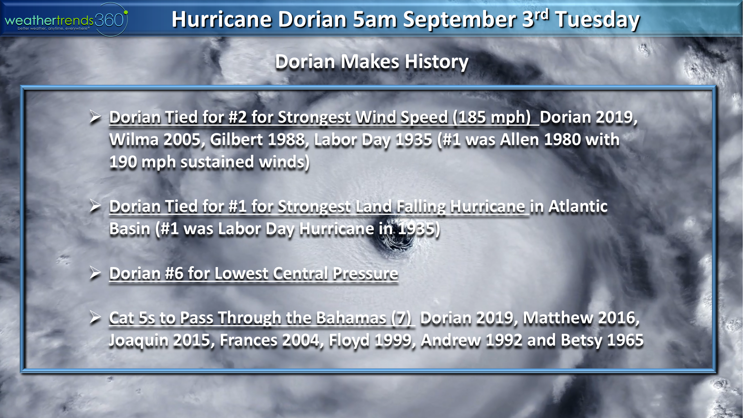
Dorian is tied for the strongest Cat 5 hurricane to make landfall with ironically the Labor Day Hurricane of 1935. The system sat over Grand Bahama for nearly 24 hours so anyone on the right side of the eyewall in Eastern Grand Bahama likely had complete destruction with sustained winds of 185 mph gusts to 220 mph Sunday into Monday.
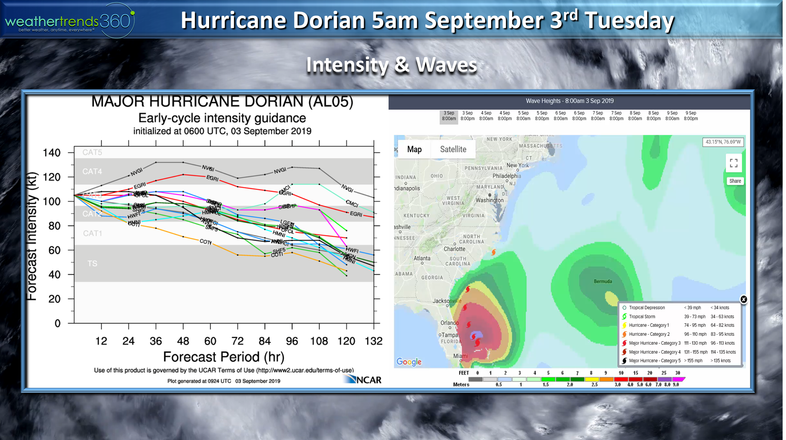
Model guidance now suggest a weakening system as it traverses up and off the Southeast U.S. coastline over the next 72 hours but still a decent storm surge in the 5 to 8 foot range along the Southeast Coastline. Biggest surge potential in the Outer Banks of North Carolina.
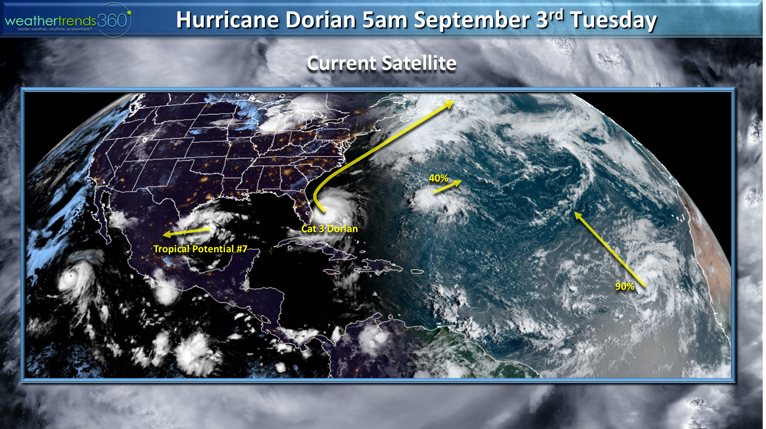
There are several other potential systems in the Gulf and Atlantic but for now the next 10 days show a lull for the U.S. after Dorian departs into the open North Atlantic.

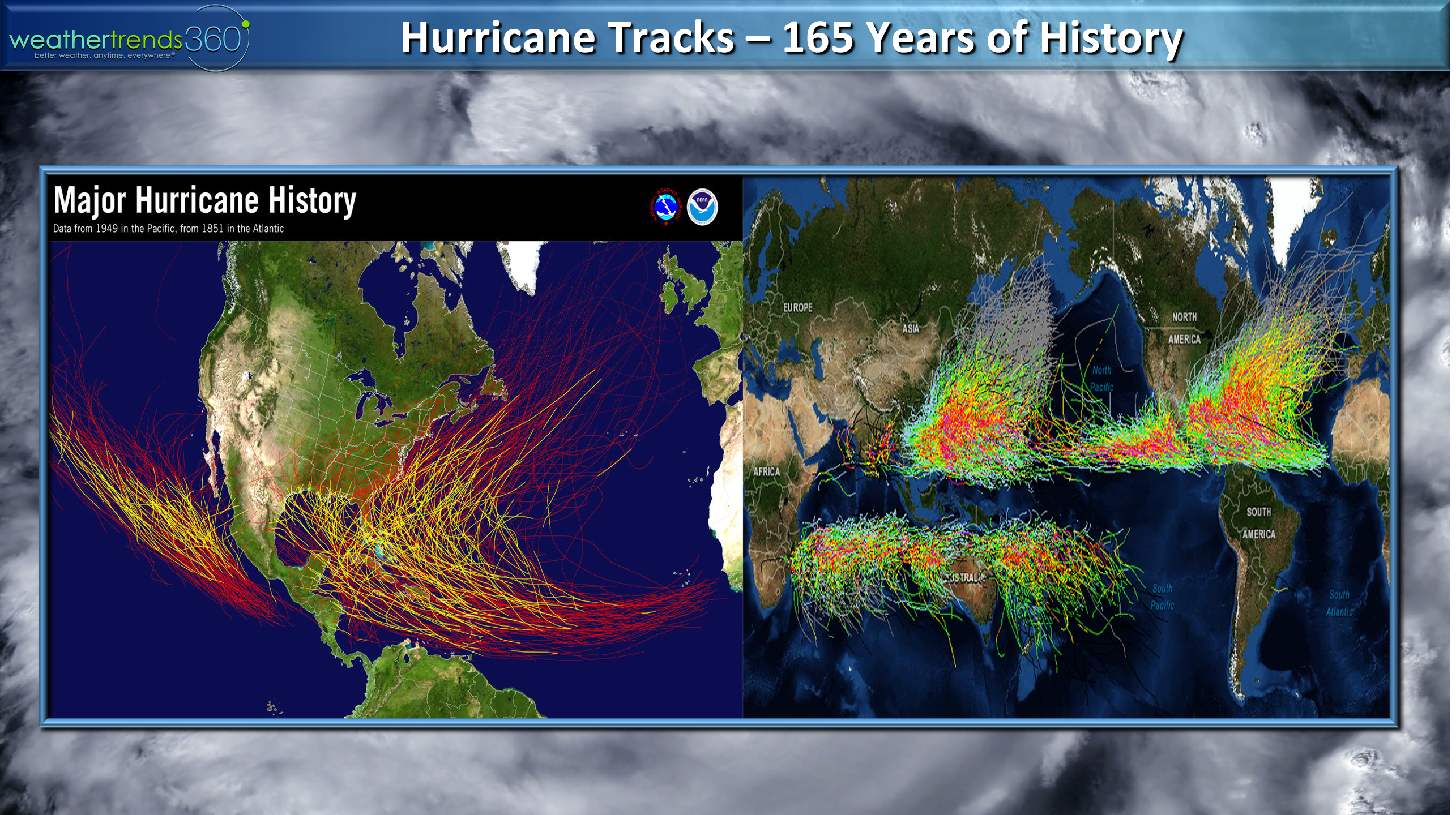
Hurricanes are pure chaos and while physics based models are better than nothing, they obviously still struggle to predict these catastrophic events. Just a week ago, not one model suggested Dorian would tie 165 years records for the strongest system in terms of wind speeds at landfall. Historical major hurricane tracks below left show you eventually get hit if you live in the tropics; all hurricane track map bottom right.
We believe our statistical/24 climate cycle approach to making longer term predictions for temperatures, rainfall, snowfall by week a year-ahead every mile on Earth and general hurricane outlooks with threat areas is a better way vs physics based modeling. It again did well saying the Bahamas, Eastern Florida and Bermuda were the highest risk targets this year. Let's hope the rest of the season isn't as bad as this week.
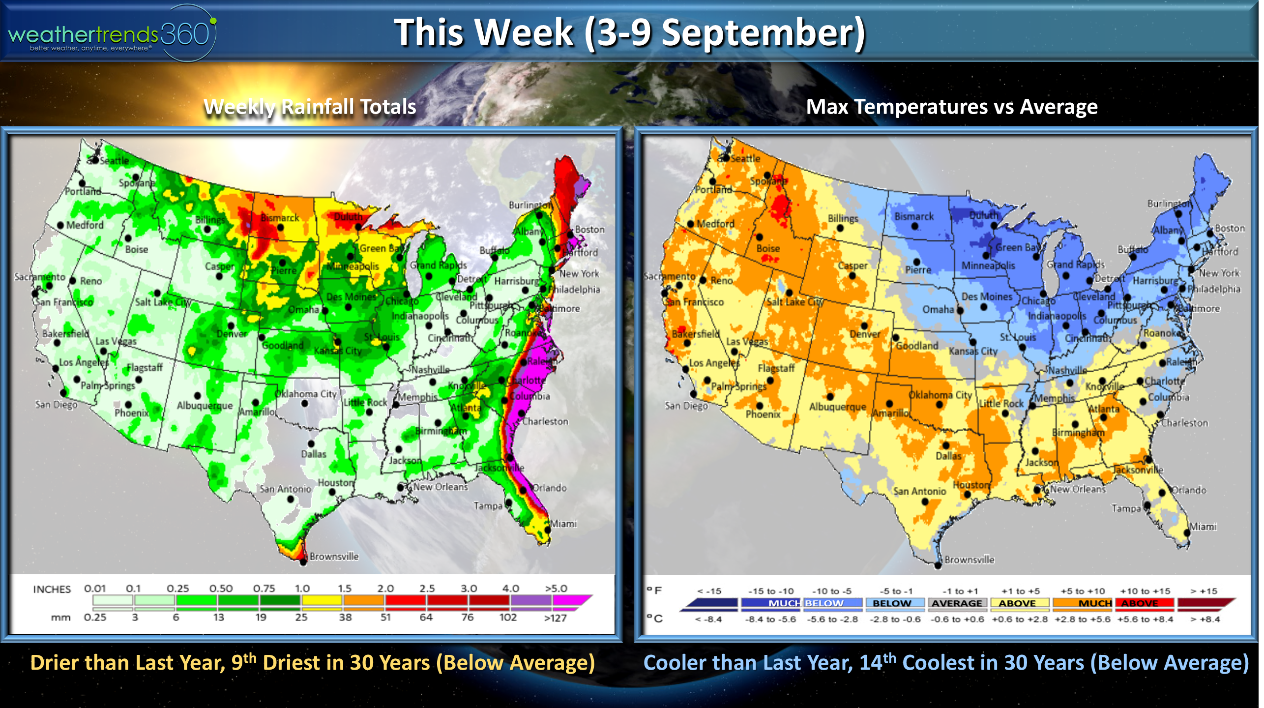
This week (3-9 Sept) looks to trend cooler than last year, 14th coolest of the past 30 years, drier than last year, 9th driest in 30 years. Midwest-Northeast the cool spot, South and West hot.
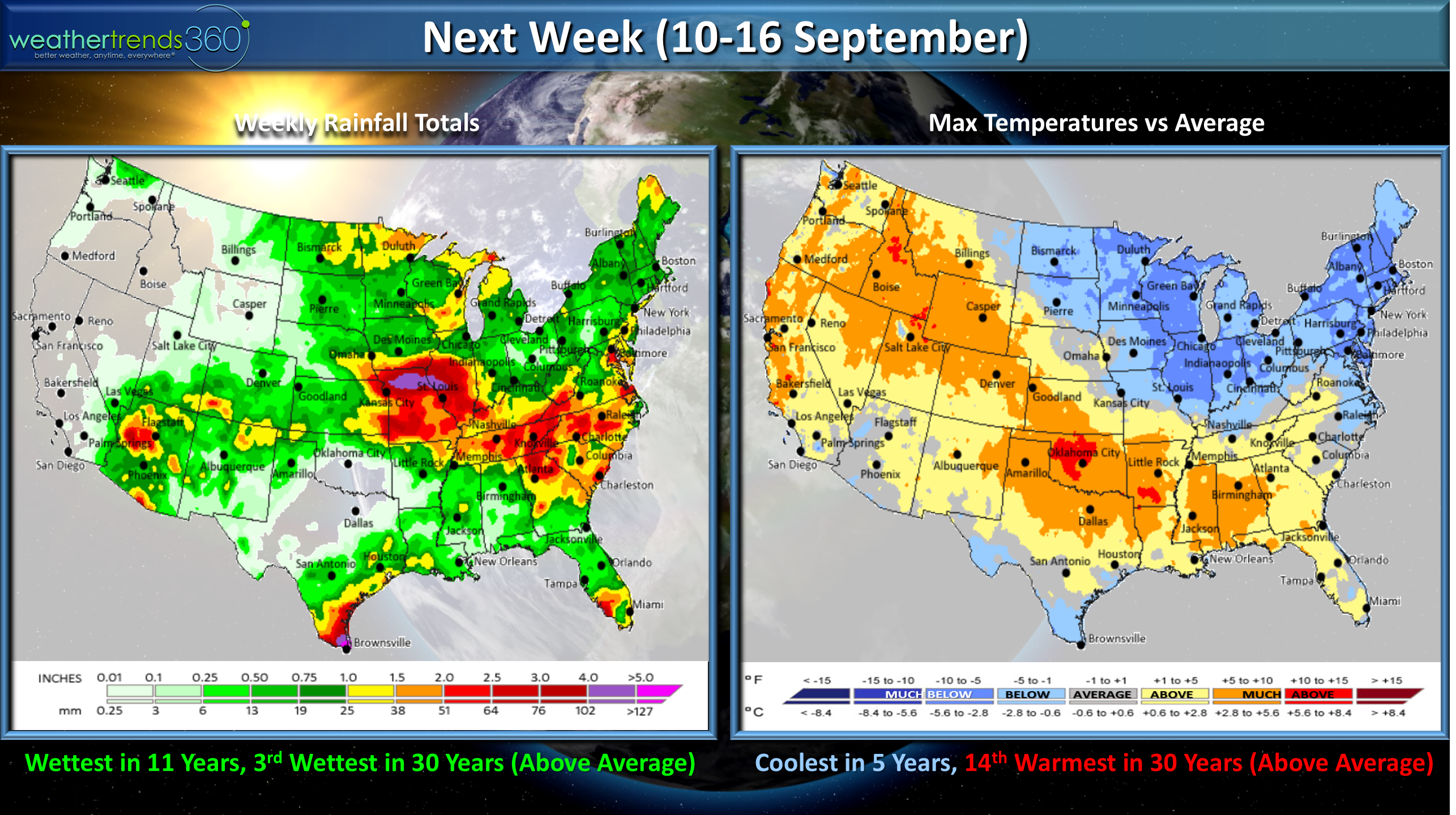
Next week (10-16 Sept)same general trend with the U.S. trending coolest in 5 years nationally and wettest in 11 years.
 The 2-week world outlook (3-16 Sept) shows Eastern Canada, Eastern U.S., Western Europe are the cool spots with Brazil warmest in 5 years while Argentina is below average (still Winter).
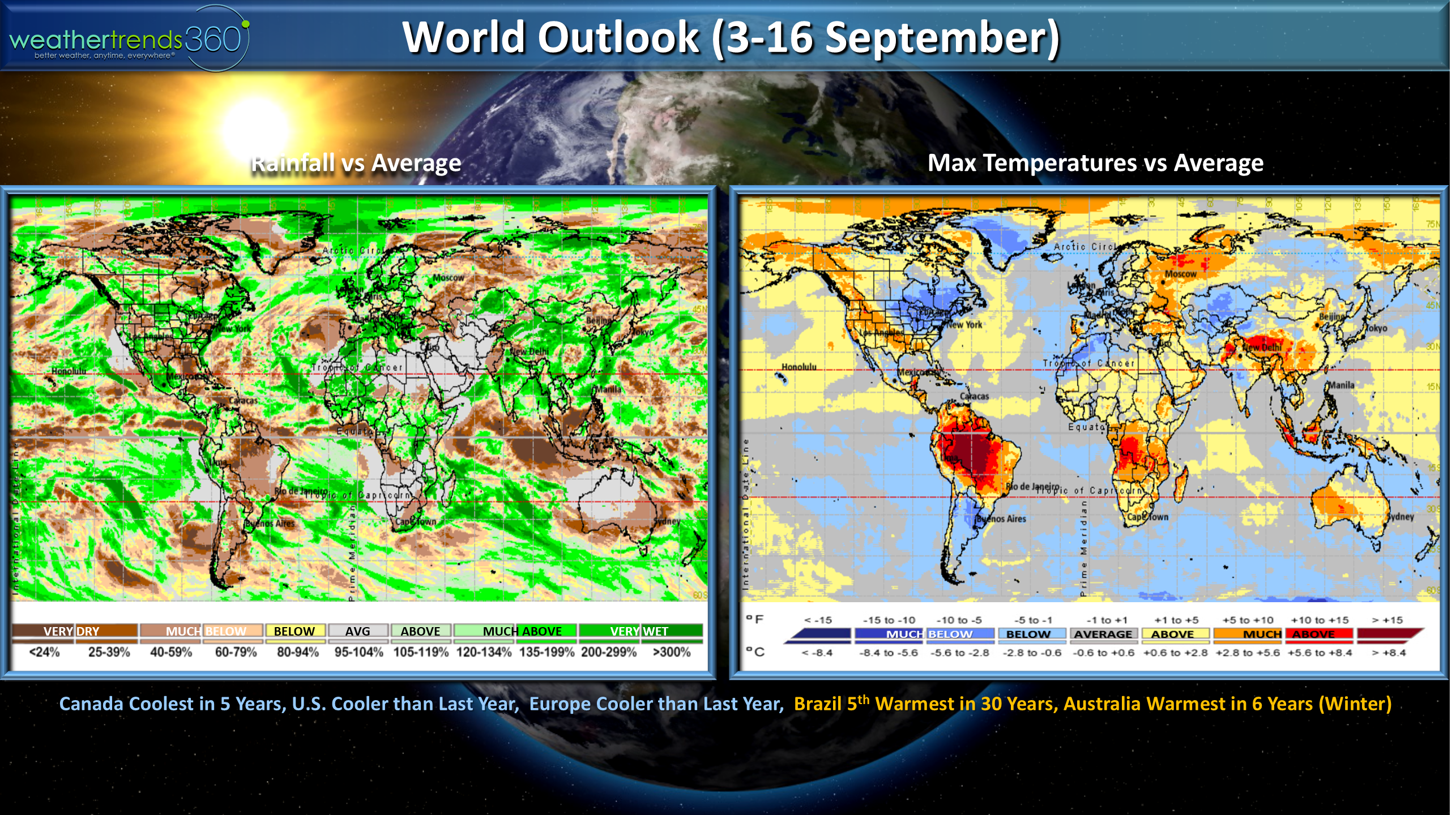 It's officially back2school for everyone with kids in the Northeast starting school today. The little Angelina was super excited to go to pre-school...we were warned time would fly by and it has...they grow up too fast.
Have a SAFE week and we'll have daily updates on Dorian on our social media pages:Facebook,Twitter,YouTube,PinterestandLinkedin
- Captain Kirk out.