Star Date 31 July 2017 Monday
Captain's Log
Happy Monday! :)
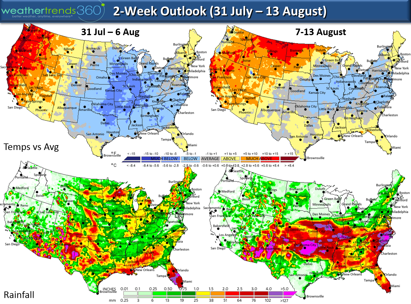
Can you believe today is the last day of July? Summer zipping by at warp speed. No major changes to the recent pattern that is keeping the Western and Central U.S. hot while the Eastern and Southern U.S. continues to trend near average to the cooler side but still very humid with all the recent rains. The 50s over the weekend were a welcome reprieve in the East from the humid weather. Cool of course is still warm in Summer but no major heat-waves in the near future other than the West. CLICK ON IMAGES FOR LARGER VIEW.
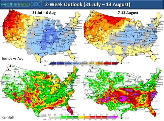
Meteorological Summer (1 June - to date) has been cooler than last year for the Southeast, East and Great Lakes with the hotter spots in the Pacific Northwest, Northern Rocky Mountains and Upper Plains. The much wetter pattern in the Eastern U.S. (except Virginia) this year has made for some very humid days but not so bad in terms of extremely hot conditions like last year. The Midwest to Northwest has been much drier than last year with some negative impacts on crops.
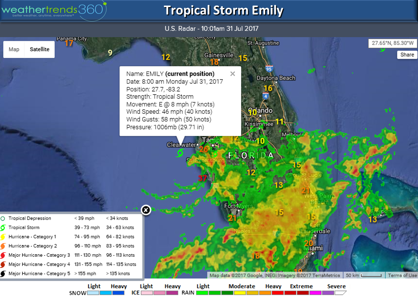
The tropical disturbance off Tampa Florida was named today, Emily, but it will be a very short lived tropical storm as it moves into Tampa Bay and then across the state today. It might regain some steam as it moves off the Southeast U.S. but should just head out to sea as a weak system with the only impact being heavier rain in the Sunshine State.

The most intense tropical system is Super Typhoon Noru which was a category 5 last night with gusts up to 200 mph! It's weakened a tad but continues to meander well South of Japan. It may eventually impact southern Japan but it will be a slow process.
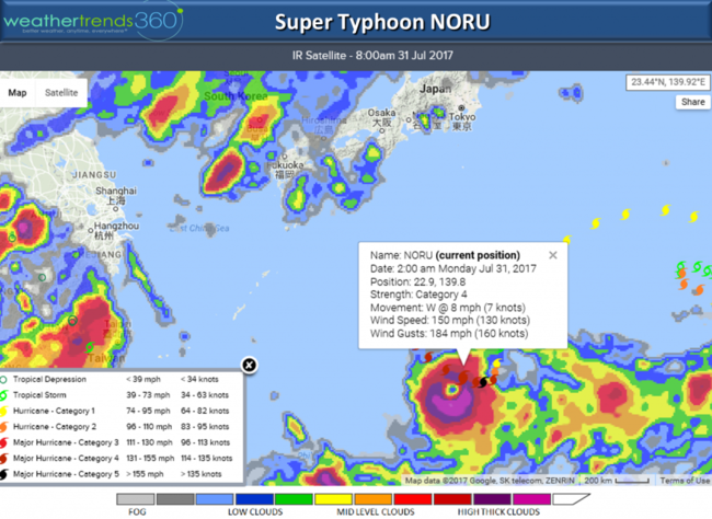
The Pacific clearly has been acting like a weak central based El Niño which is more favorable for active Pacific tropical systems but it tends to suppress activity in the Atlantic while also making it very wet on the U.S. East Coast. The position of the Bermuda High Pressure center in the Atlantic is bring some wind off Western Sahara, Mauritania Africa which allows dust and drier air to suppress systems coming off Africa. This suggests the near term outlook is relatively quiet other than Emily.
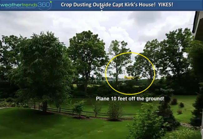
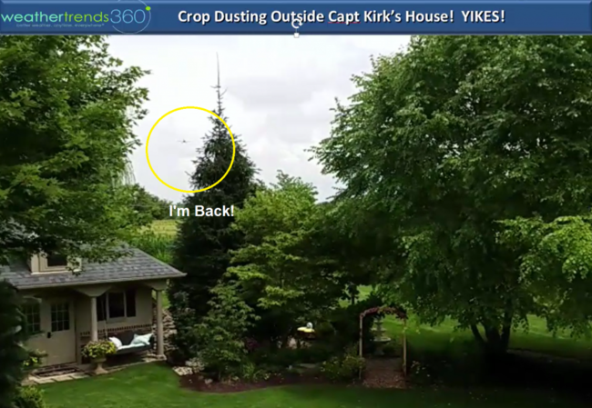
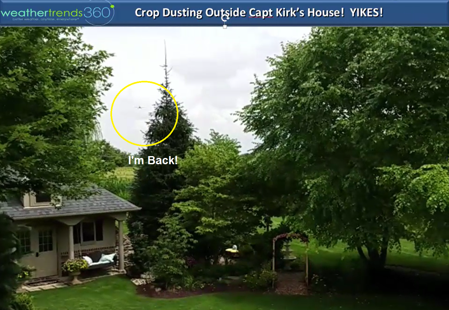
We had our own air show near wt360 headquarters this past weekend as a plane made some pretty crazy acrobatic moves while crop dusting the local corn fields! Visit our facebook page for the full scary video!!!

 We hope you have a great week! - Captain Kirk out.
Can you believe today is the last day of July? Summer zipping by at warp speed. No major changes to the recent pattern that is keeping the Western and Central U.S. hot while the Eastern and Southern U.S. continues to trend near average to the cooler side but still very humid with all the recent rains. The 50s over the weekend were a welcome reprieve in the East from the humid weather. Cool of course is still warm in Summer but no major heat-waves in the near future other than the West. CLICK ON IMAGES FOR LARGER VIEW.
Meteorological Summer (1 June - to date) has been cooler than last year for the Southeast, East and Great Lakes with the hotter spots in the Pacific Northwest, Northern Rocky Mountains and Upper Plains. The much wetter pattern in the Eastern U.S. (except Virginia) this year has made for some very humid days but not so bad in terms of extremely hot conditions like last year. The Midwest to Northwest has been much drier than last year with some negative impacts on crops.
The tropical disturbance off Tampa Florida was named today, Emily, but it will be a very short lived tropical storm as it moves into Tampa Bay and then across the state today. It might regain some steam as it moves off the Southeast U.S. but should just head out to sea as a weak system with the only impact being heavier rain in the Sunshine State.
The most intense tropical system is Super Typhoon Noru which was a category 5 last night with gusts up to 200 mph! It's weakened a tad but continues to meander well South of Japan. It may eventually impact southern Japan but it will be a slow process.

The Pacific clearly has been acting like a weak central based El Niño which is more favorable for active Pacific tropical systems but it tends to suppress activity in the Atlantic while also making it very wet on the U.S. East Coast. The position of the Bermuda High Pressure center in the Atlantic is bring some wind off Western Sahara, Mauritania Africa which allows dust and drier air to suppress systems coming off Africa. This suggests the near term outlook is relatively quiet other than Emily.
We had our own air show near wt360 headquarters this past weekend as a plane made some pretty crazy acrobatic moves while crop dusting the local corn fields! Visit our facebook page for the full scary video!!!


 We hope you have a great week! - Captain Kirk out.