Star Date 4 February 2019 Monday
Captain's Log
Happy Monday!
A lot to cover in today's video as we recap January and look ahead into Spring and even some teasers of our Summer outlook. CLICK ON IMAGES FOR A LARGER VIEW.
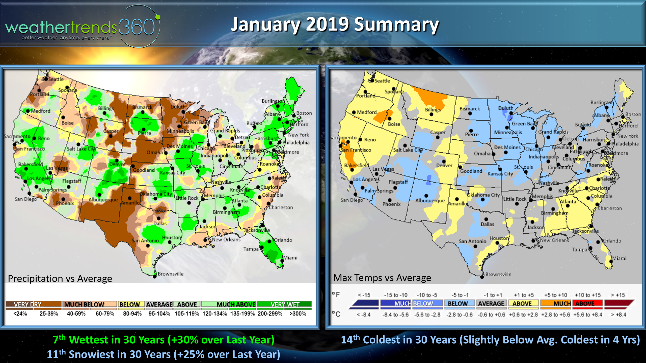
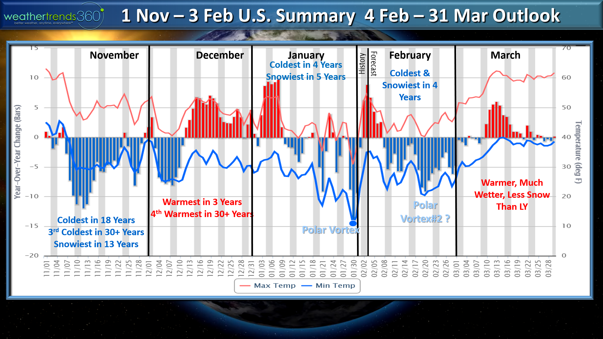
The calendar 1-31 January ended up being the coldest in 14 years, 14th coldest in 30 years for max temperatures for the U.S. as a whole, 7th wettest in 30 years (+30% over last year) and 11th snowiest in 30 years (+25% over last year).
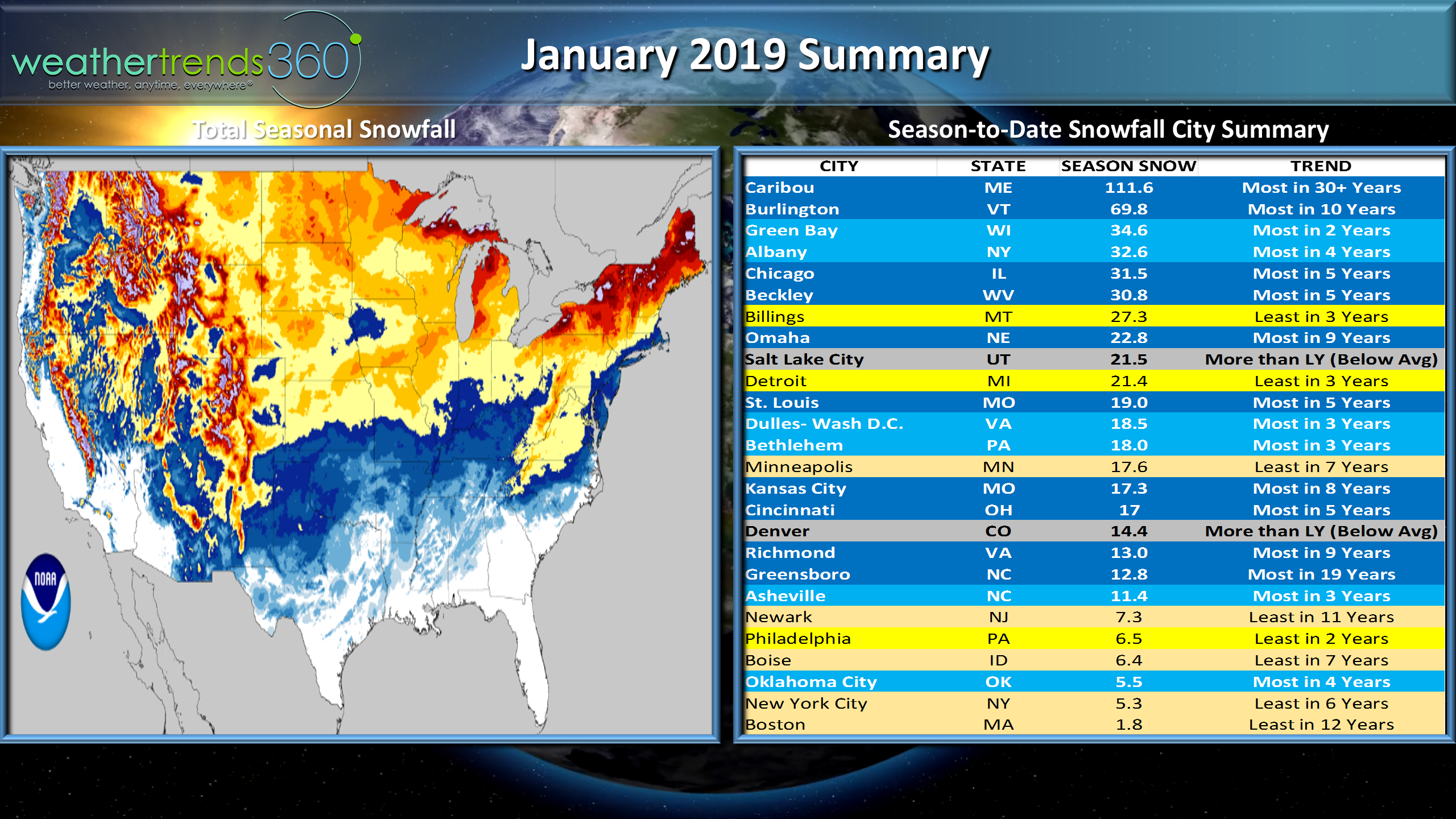
Season to date snowfall across the U.S. through 31 January shows some amazing differences across small geographies so you either a happy snow lover or not so happy. The Philly to Boston corridor and points south are generally in the not happy camp in terms of how much snow has fallen. Atlantic City as an example has 10.9" of snow to date which is just a tad above average but just up the turnpike there's only been 7.3" in Newark, the least in 11 years. Toward the Poconos in PA its above average with 24"+ and most in 4 years and up toward Binghamton NY 60.3" has fallen which is well above average. So, hit or miss but we'll certainly be adding a lot of snow between now and early March.
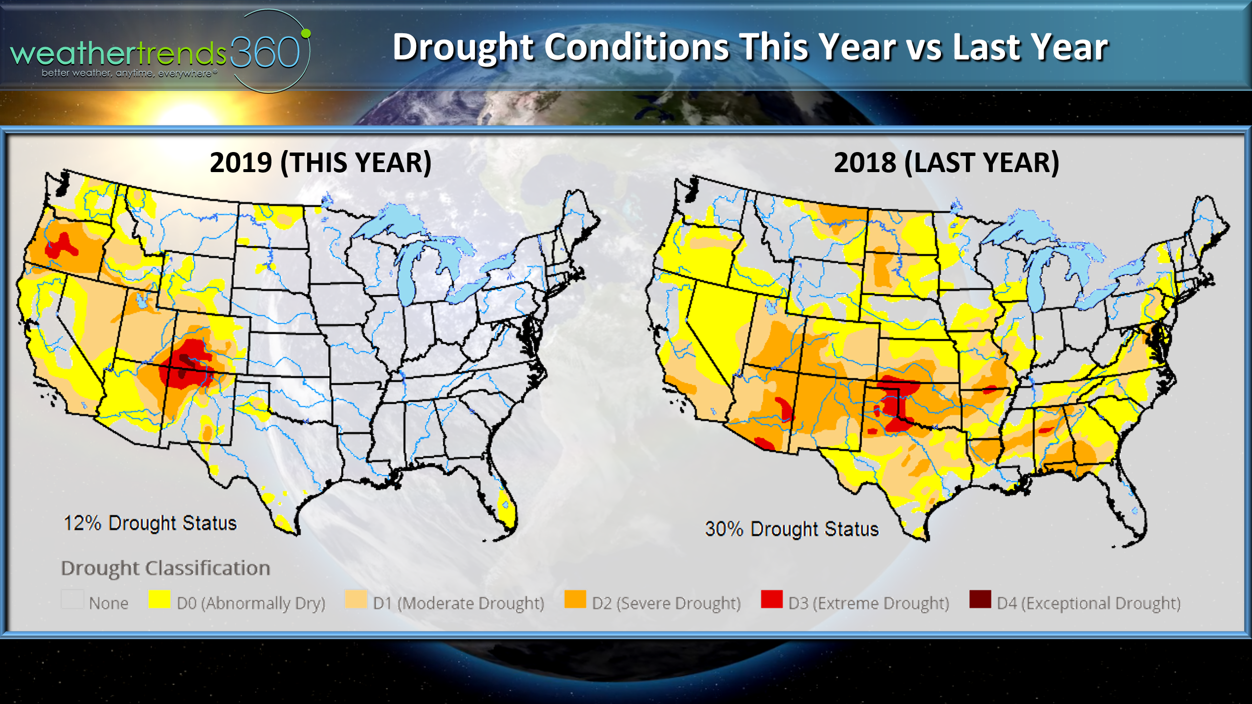
One positive to all the rain and snow is drought is significantly less than last year with 2/3rds of the Eastern half of the U.S. drought free as opposed to last year when 30% of the country was in some sort of drought as of late January.
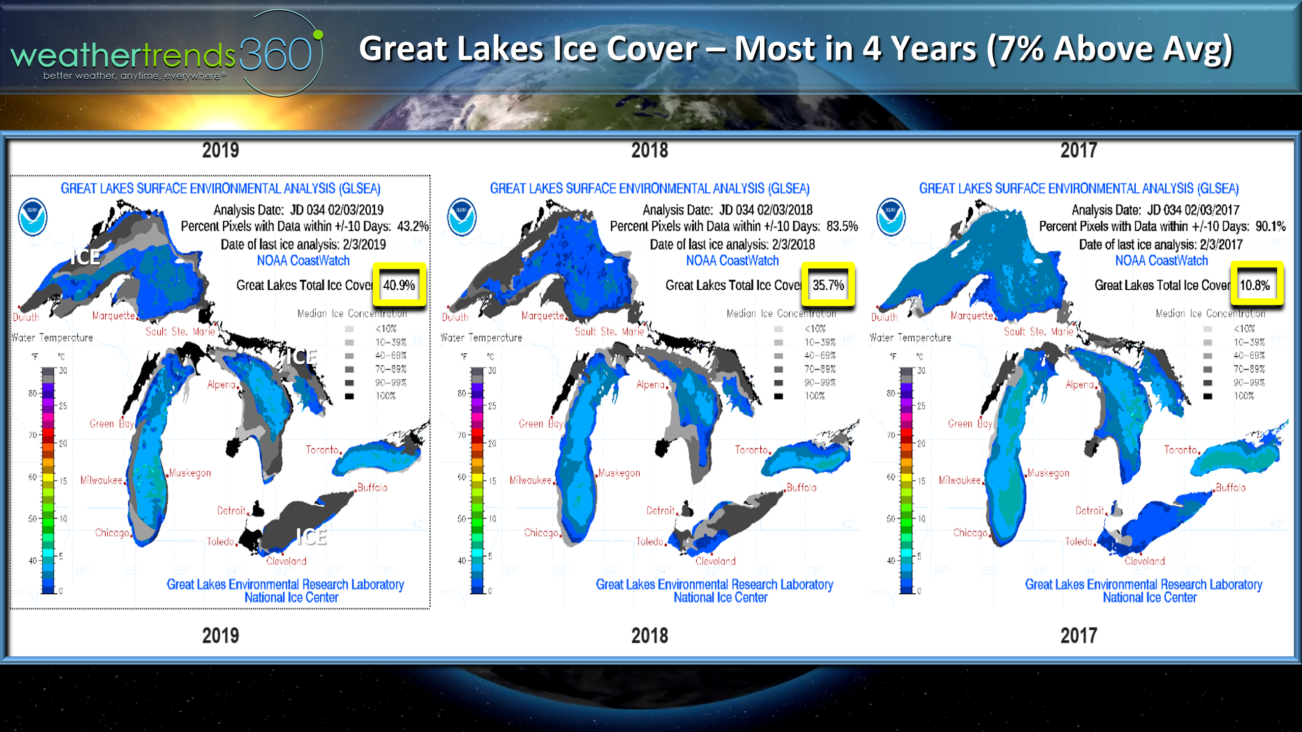
The recent Polar Vortex certainly increased the ice cover on the Great Lakes which now covers nearly 41% which is 7% above average and the most coverage in 4 years. Lake Erie is almost completely ice covered which is helping to make it sunnier here in Pennsylvania with less moisture off the lakes. It also tends to shut down the Lake Effect snows as well.
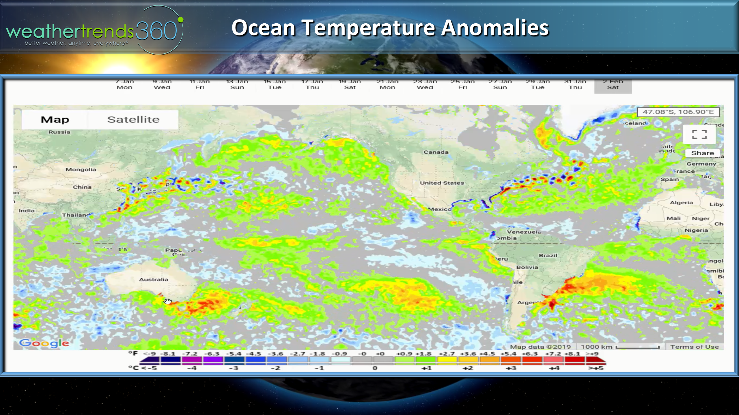
The broader oceans show we're still in a very weak El Nino but quite frequently the atmosphere is not entirely responding as it should. This week for example is acting more like a La Nina in the East and Ohio Valley.
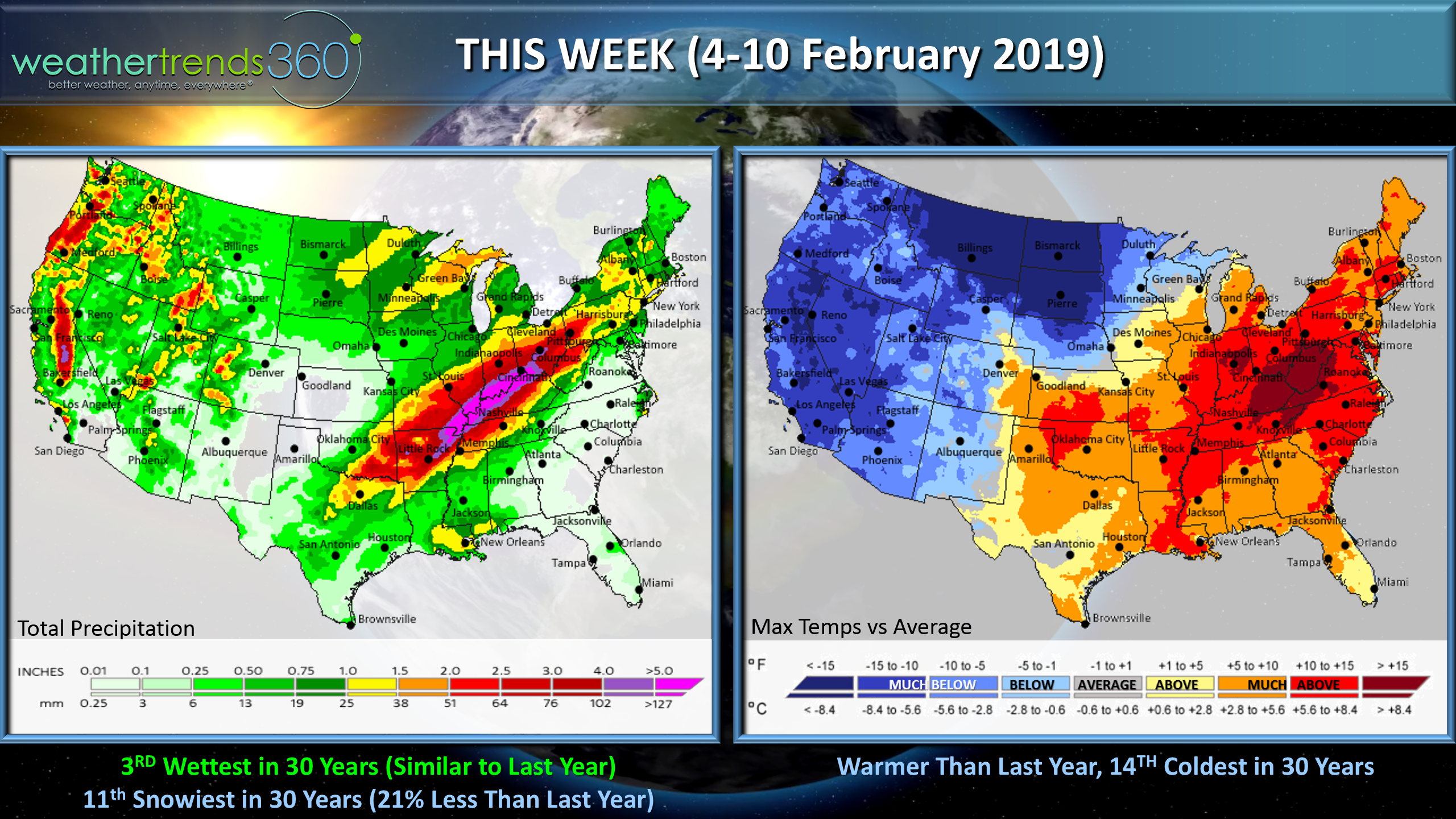
This week (4-10 Feb) for the U.S. overall it is a dichotomy of two halves as the Polar Vortex has lifted out allowing a big warmer surge to invade the East for a February Thaw while the West and especially the Northwest gets a good blast of Winter with snow falling in Seattle. For the U.S. overall its a tad warmer than last year, 14th coldest in 30 years, 3rd wettest in 30 years which is similar to last year's wet week and 11th snowiest in 30 years but 21% less than a year ago.
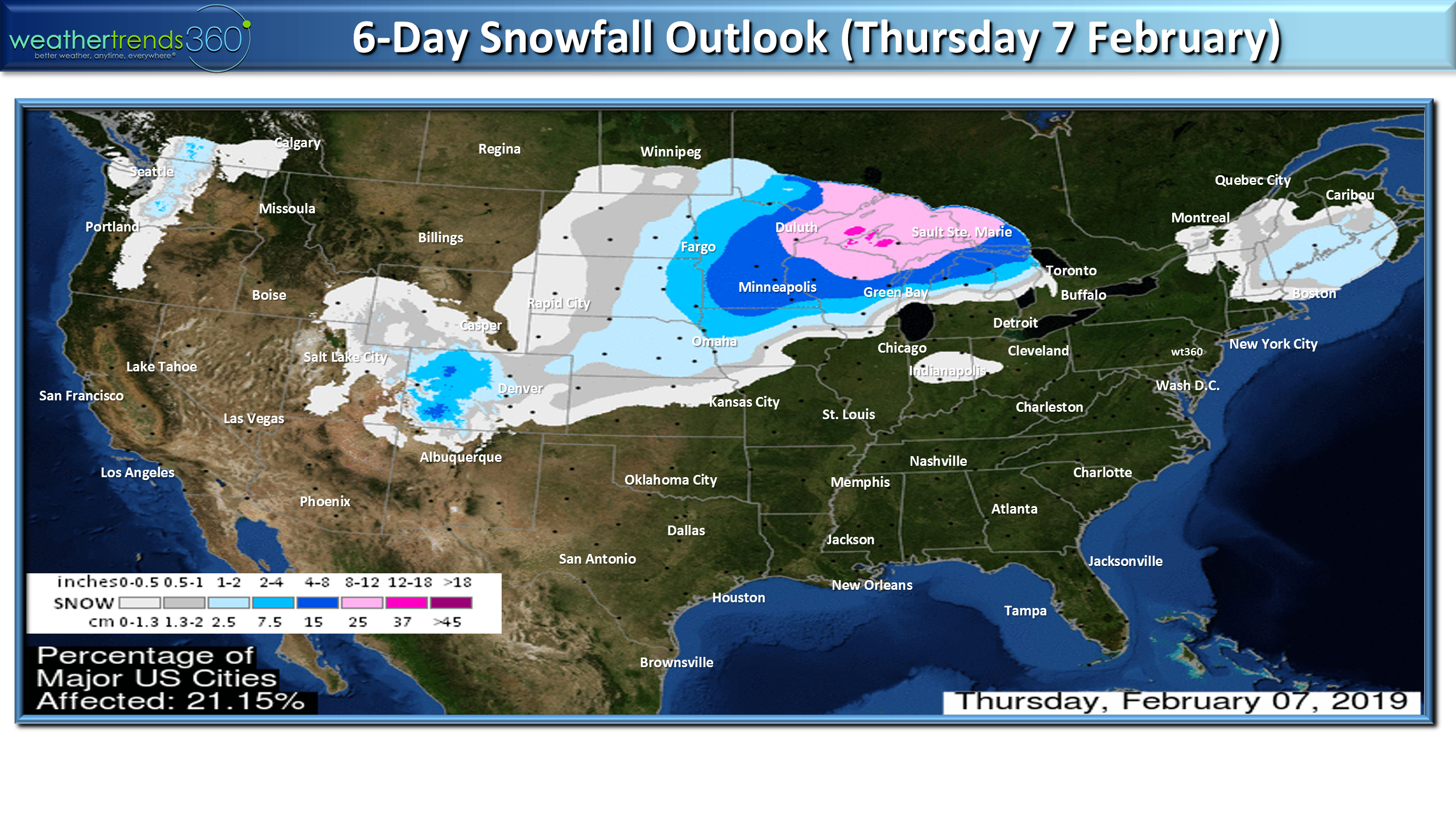
A couple snow storms will move out of the West towards the Upper Midwest and Great Lakes with the bigger of the two midweek.
Next week the snowfall could get more interesting of the Northeast as the middle to late February time-frame under these climate cycles are historically favorable for bigger snow events.
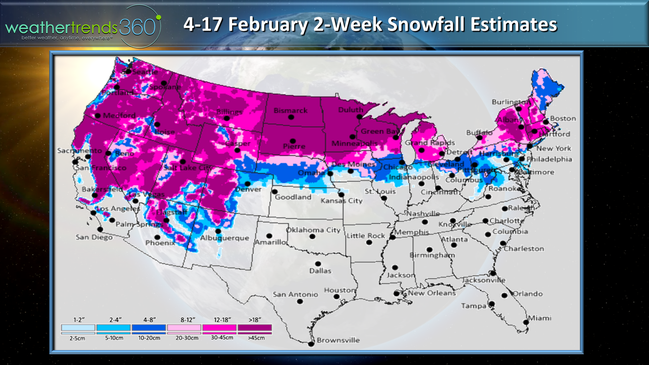
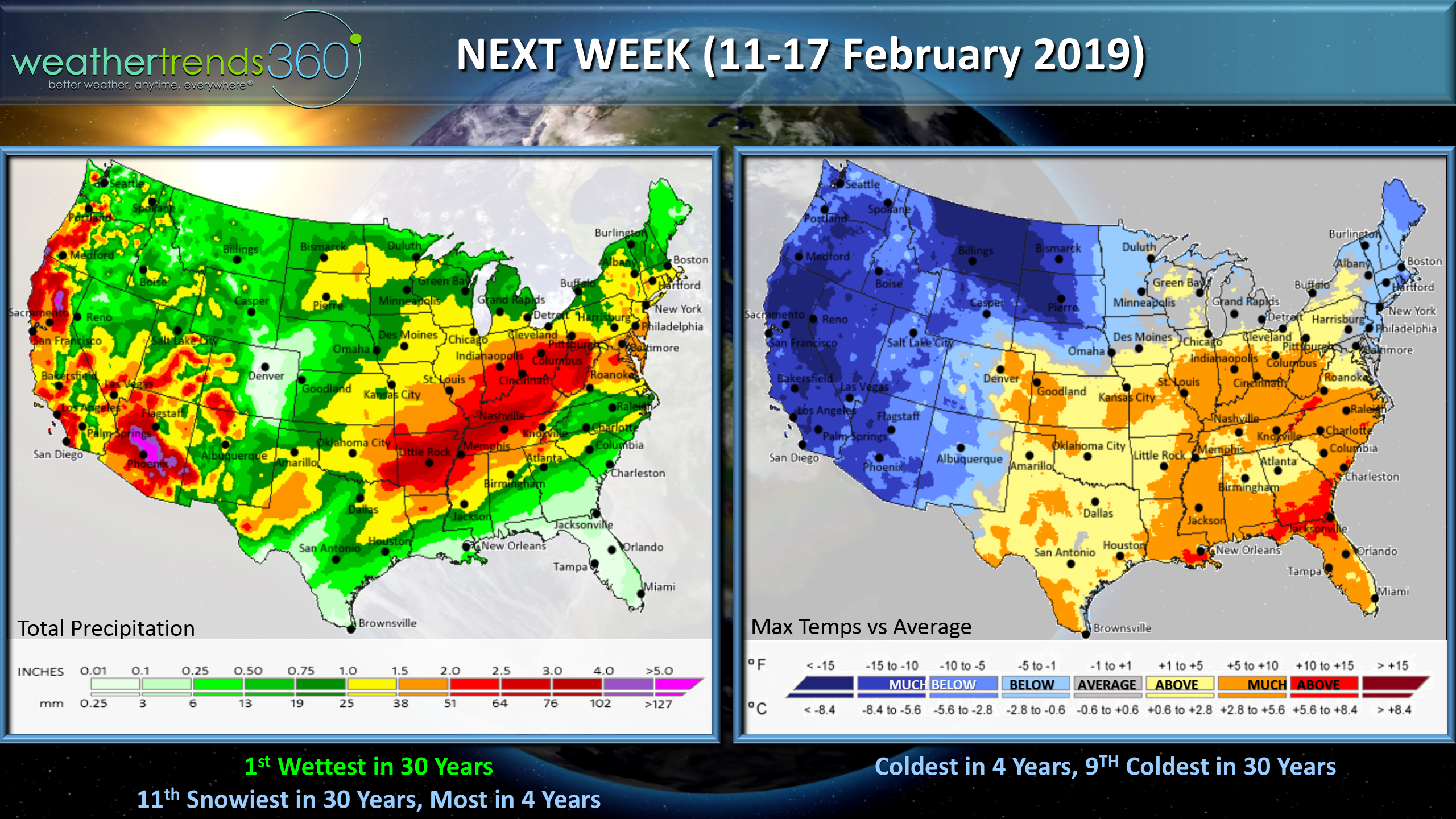
Next week (11-17 Feb) the cold remains in the West but also starts to invade the Great Lakes and Northeast, pushing the milder weather into the Southeast. For the U.S. overall the week looks to trend the coldest in 4 years (9th coldest in 30 years), #1 wettest in 30 years and 11th snowiest in 30 years, most in 4 years.
While the Groundhog says Spring will be early, we probably have 4-5 more weeks of potentially very cold and snowy conditions and one more visit of the Polar Vortex, but beyond that March and especially April look to be in sync with the rodent's outlook.
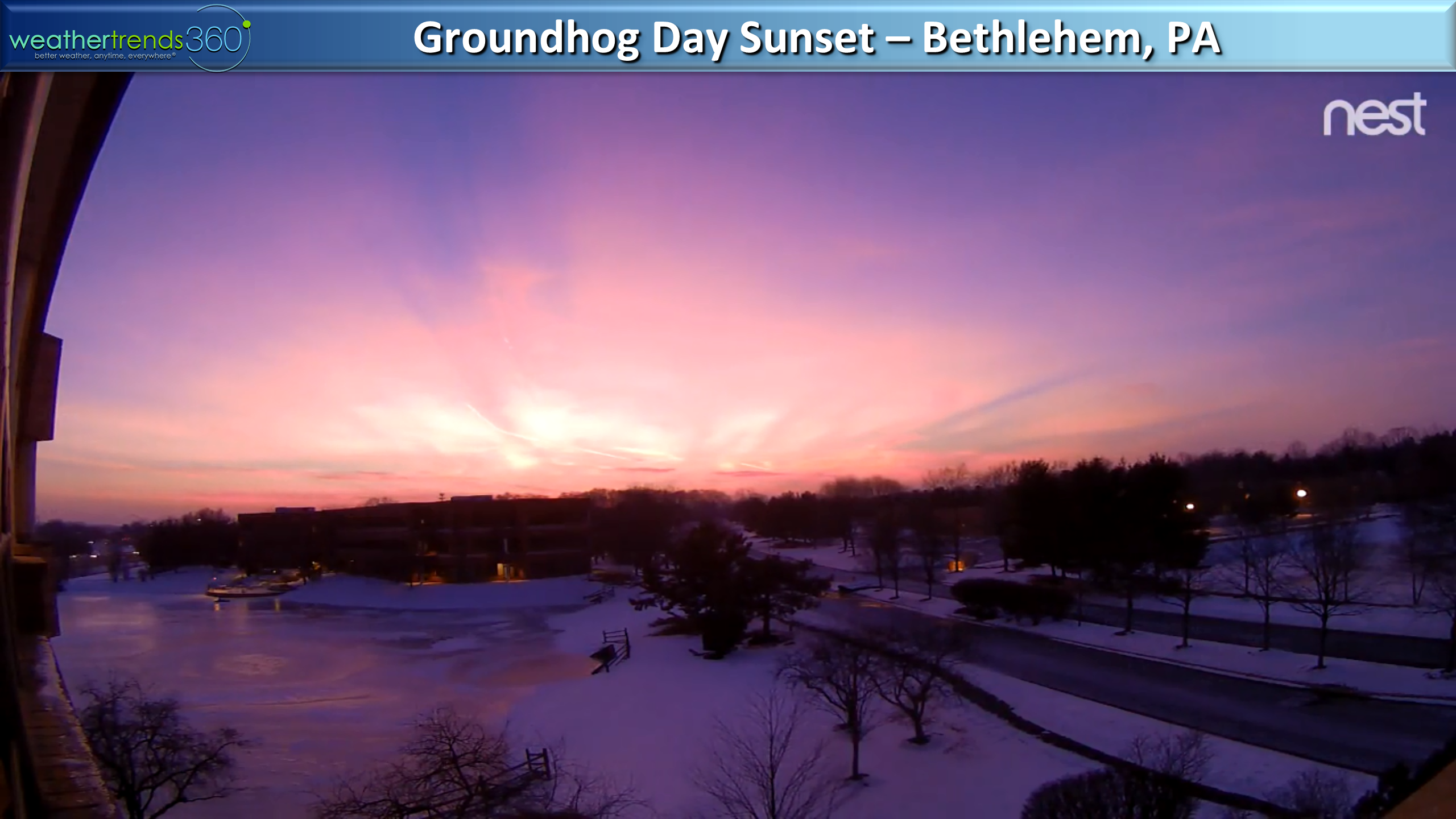
Not sure we can thank the groundhog for our beautiful Sunset on Saturday but it was spectacular. See the end of today's video for a 30 second time-lapse of the spectacular color going from orange to purple.
Have a great week and don't forget to follow us on social media for frequent updates.Facebook,Twitter,YouTube,PinterestandLinkedin
- Captain Kirk out.