Star Date 6 August 2018 Monday
Captain's Log
Happy Monday! :)
There's only 26 days left of meteorological Summer (1 June - 31 August) but if you go with the Sun's calendar we have 47 more days until Fall arrives on 22 September. We'll go with the sun! Meteorological Summer to date (1 June - 5 August) has been on the warm side across much of the U.S. and Europe. See our new Captain's Log video below.
CLICK ON IMAGES FOR LARGER VIEW.
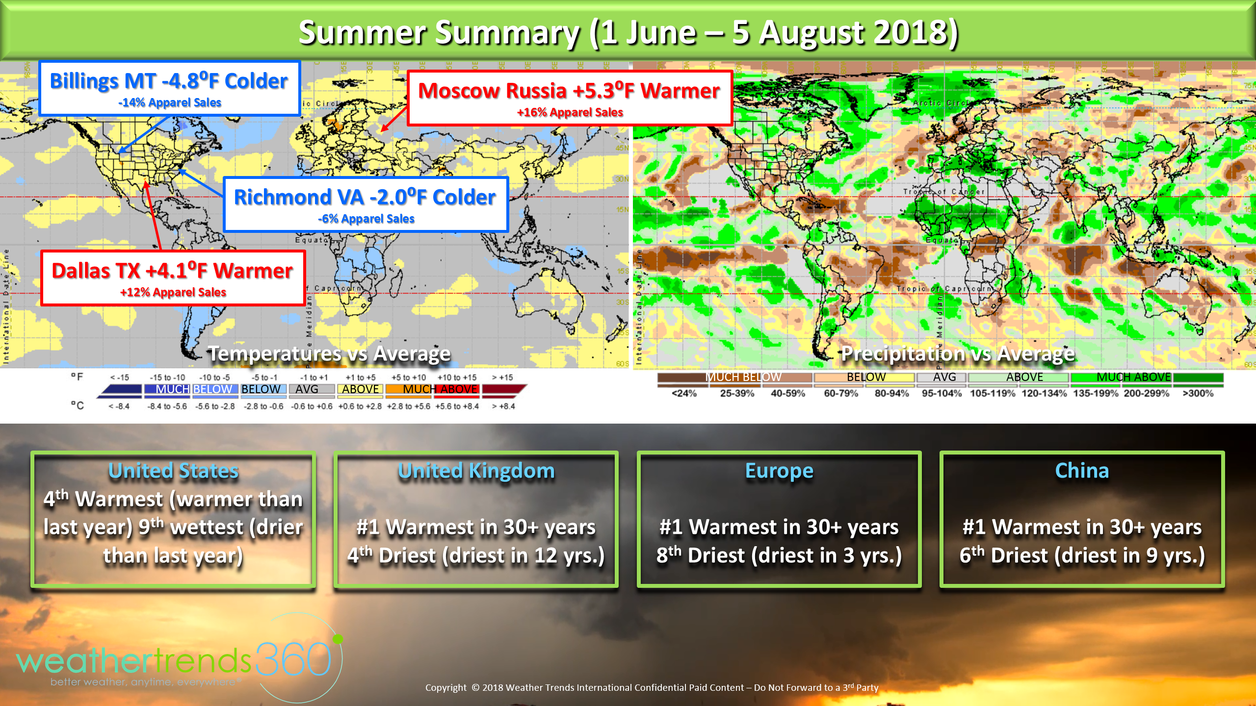
This is a big plus for seasonal merchandise sales, retail sales and the overall economy so look for very strong Q2 (May - Jul) sales results from both domestic and international businesses.
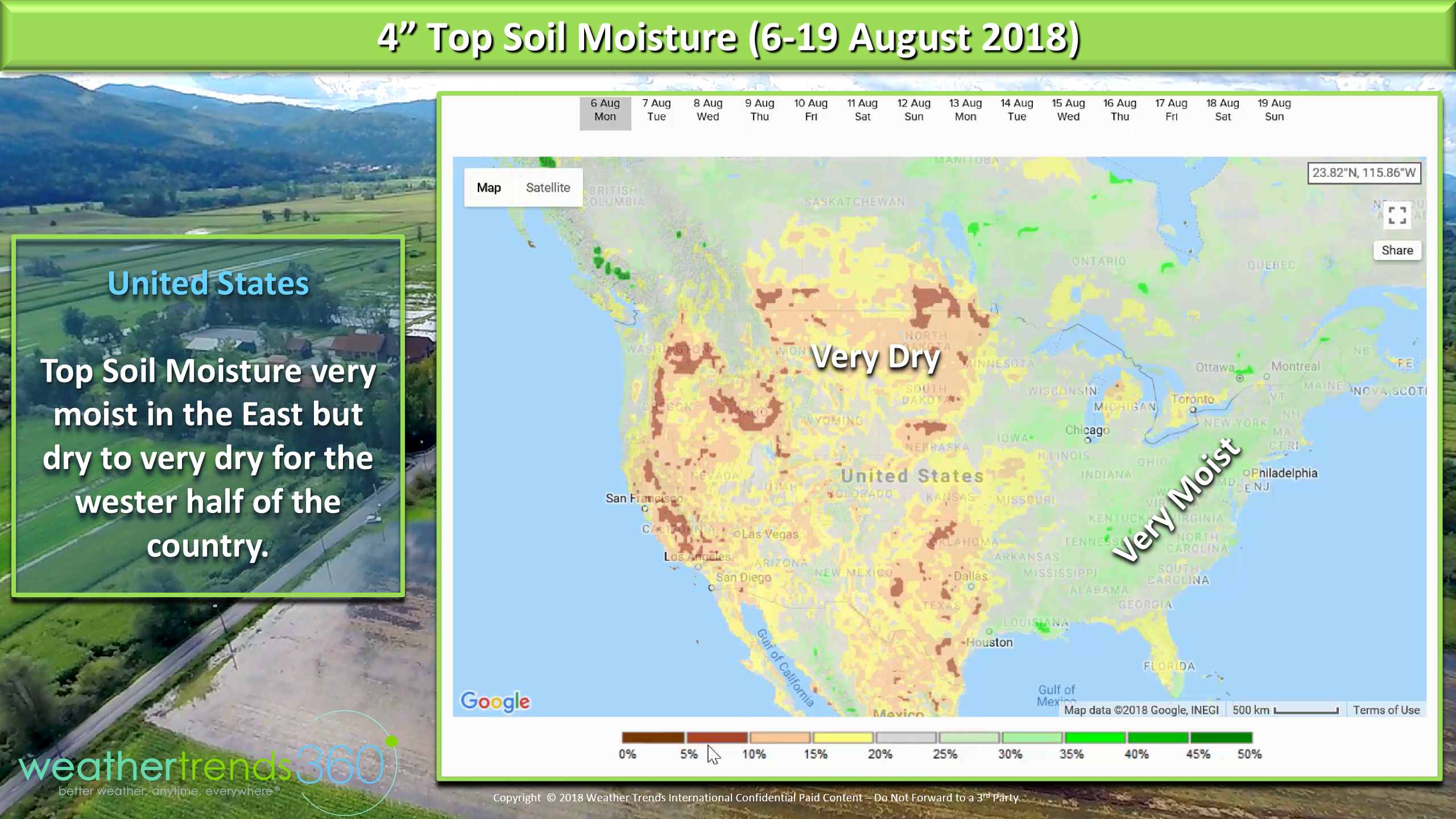
For Agribusiness the latest soil moisture map looks very moist from the Central Corn Belt throughout much of the East. The western half of the U.S. is very dry with wild fires continuing to plague California with very thick smoke actually shutting downYosemite National Park. The next 14 days show some soil moisture improvement in parts of Central TX and MO but unfortunately CA remains hot/dry with fires only 30% contained.
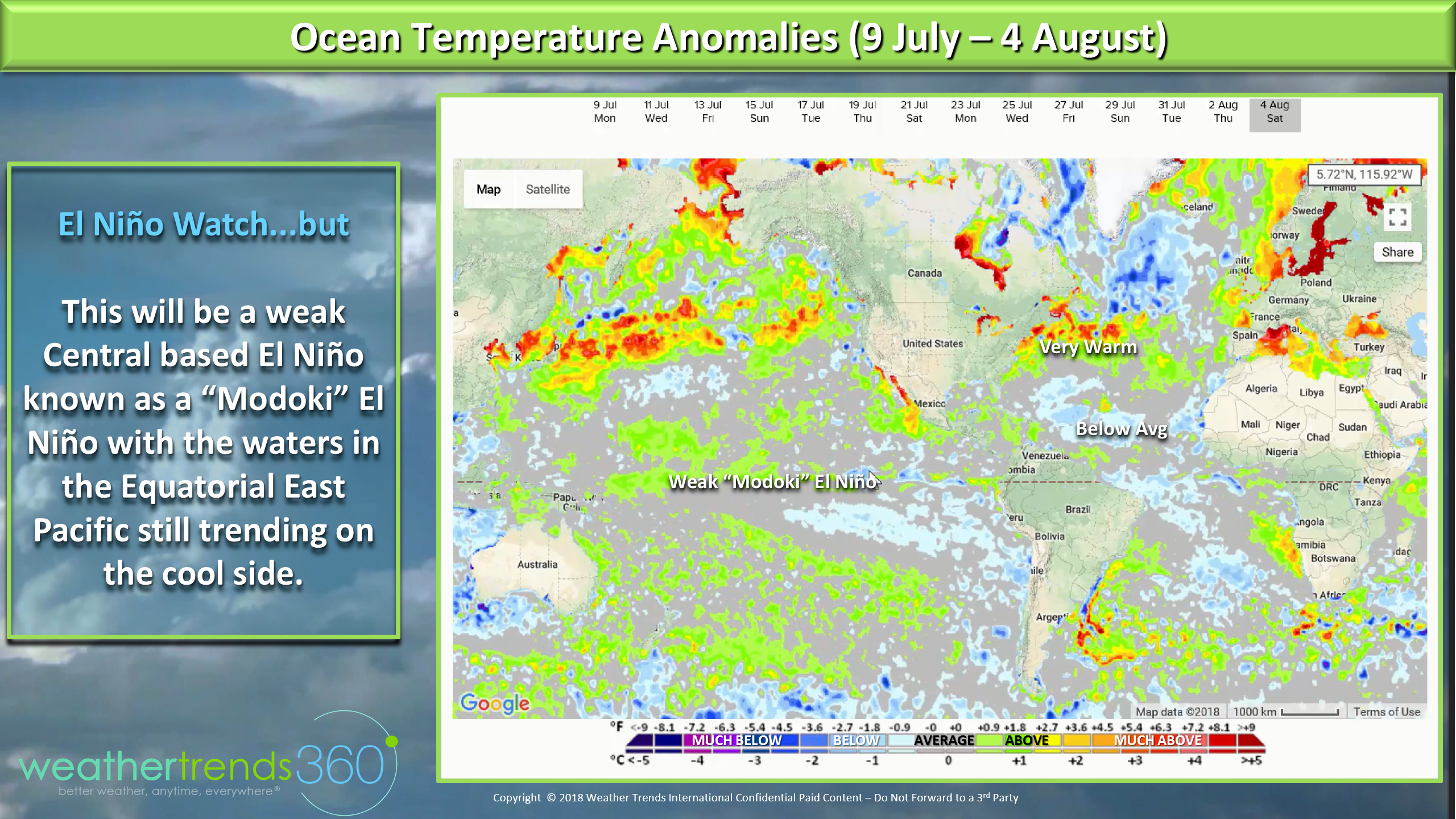
Ocean temperatures remain warm off the East Coast but other than a disturbance way out in the Atlantic it's quiet on the tropical front. Still looks like a weak El Niño Modoki is forming which is a central based El Niño as the Eastern Equatorial Pacific Ocean remains on the cool side of average. Weak central based El Niño's make for active Pacific hurricane seasons as we're seeing now, but also allow northern moving typhoons to send plunges of cold air into the U.S. as we get into Fall.
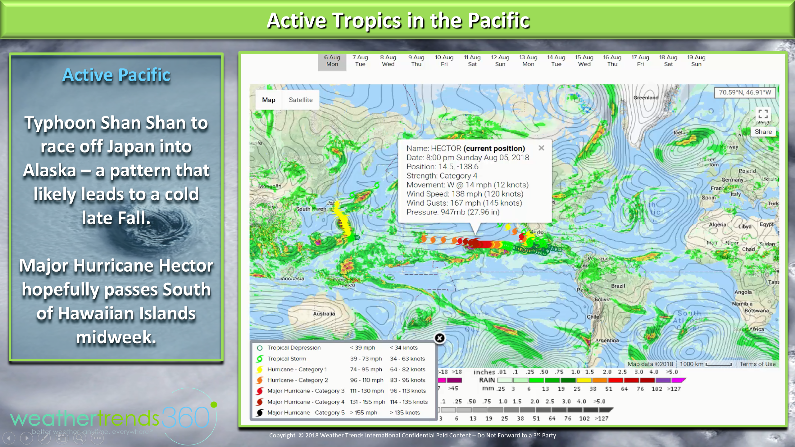
The biggest threat is Hurricane Hector which is a category 4 hurricane that hopefully passes south of the Hawaiian Islands midweek.
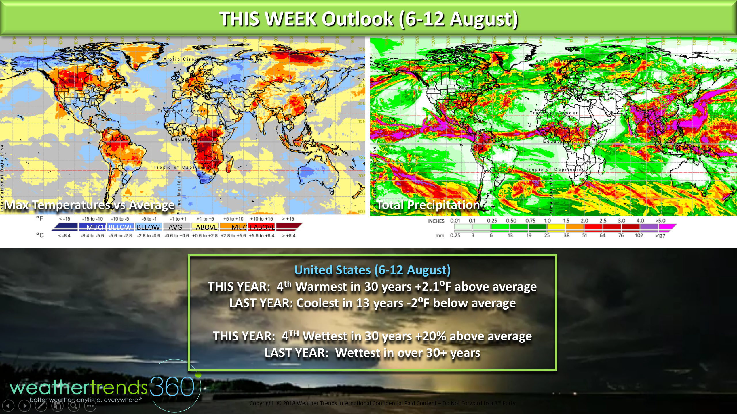
THIS WEEK (6-12 August) makes a wholesale change from last year's coldest 2nd week of August in 13 years to the 4th warmest in 30+ years for the U.S. overall. Last year was very wet trending wettest in over 30 years and this year remains generally wet trending 4th wettest of the past 30 years, 20% above average for the U.S. overall. It remain hot across Europe and Southeast China while cooler for Alaska, the southern U.S., Australia, Central Russia, Northeast China and especially South Africa.
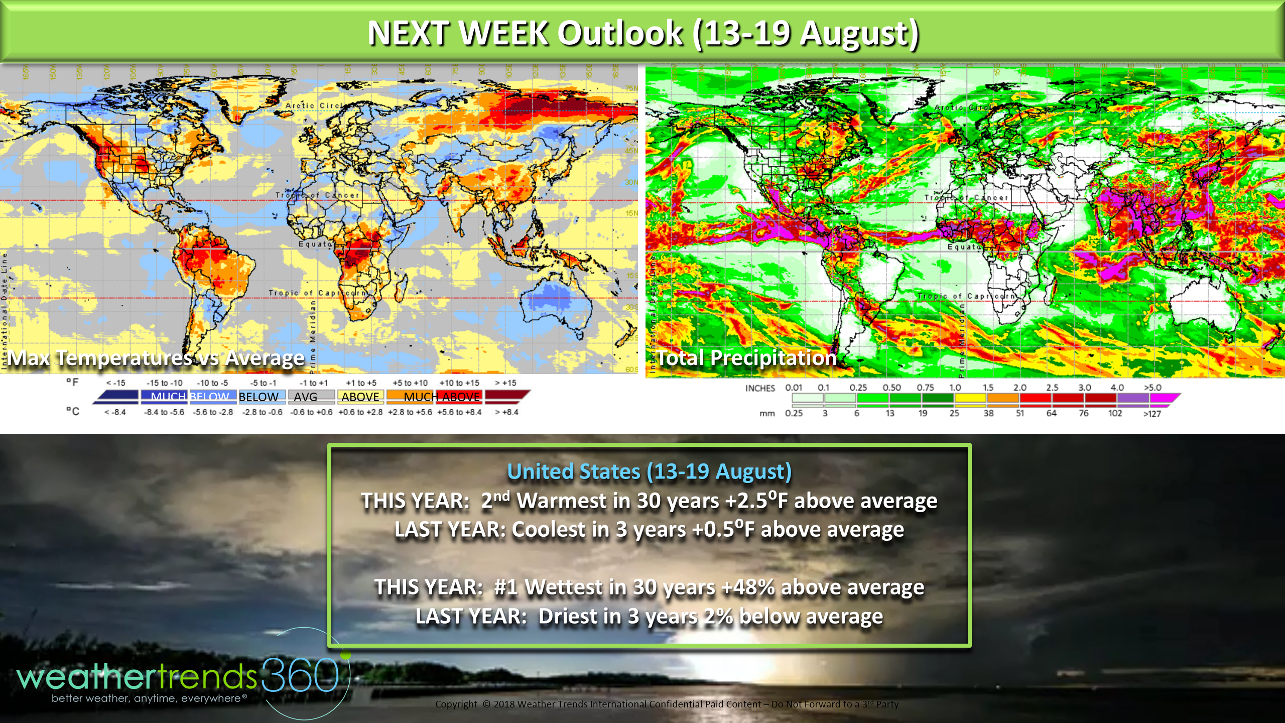
NEXT WEEK (13-19 August) starts to show some signs of a pattern shift as the remnants of Typhoon Shan Shan plunge into Alaska bringing cooler air to Central Canada. For the U.S. overall the pattern remains warm but again signs of change. Overall the week trends 2nd warmest in 30 years vs last year which was the coolest in 3 years. Rainfall is again very wet for the U.S. overall trending #1 wettest of past 30 years vs last year trending the driest in 3 years. The hot/wet pattern is good for hot summer category clearance sales but not good for early Fall back2school items.
We hope you have a great week and don't forget to follow us on social media for frequent updates.Facebook,Twitter,YouTube,PinterestandLinkedin
- The "REAL" Captain Kirk out (USAF Gulf War Veteran 1989-1999)