Star Date: 6 February 2017 Monday
Captain's Log
Happy Monday folks!
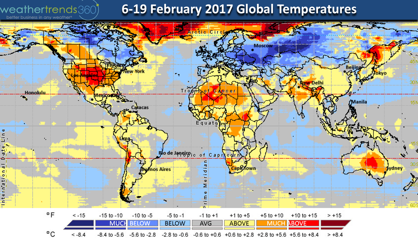
For the now the global pattern is somewhat stuck with cold air bottled up in Europe and Russia but that's likely to change late in February into March.
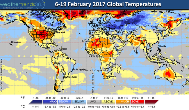
Global 2-week temperature trends for the period overall. Keep in mind there will be ups and downs even in the Northeast U.S.
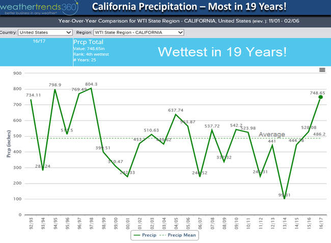
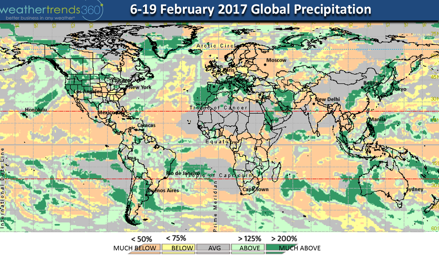
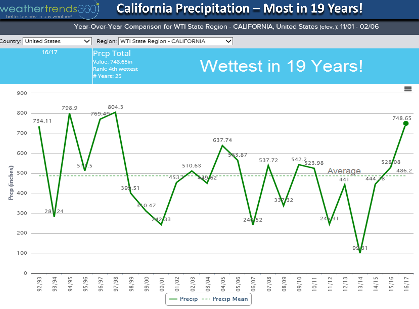
Global 2-week precipitation trends. California remains wet as they add to their wettest winter in 19 years.

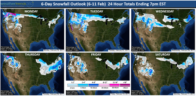
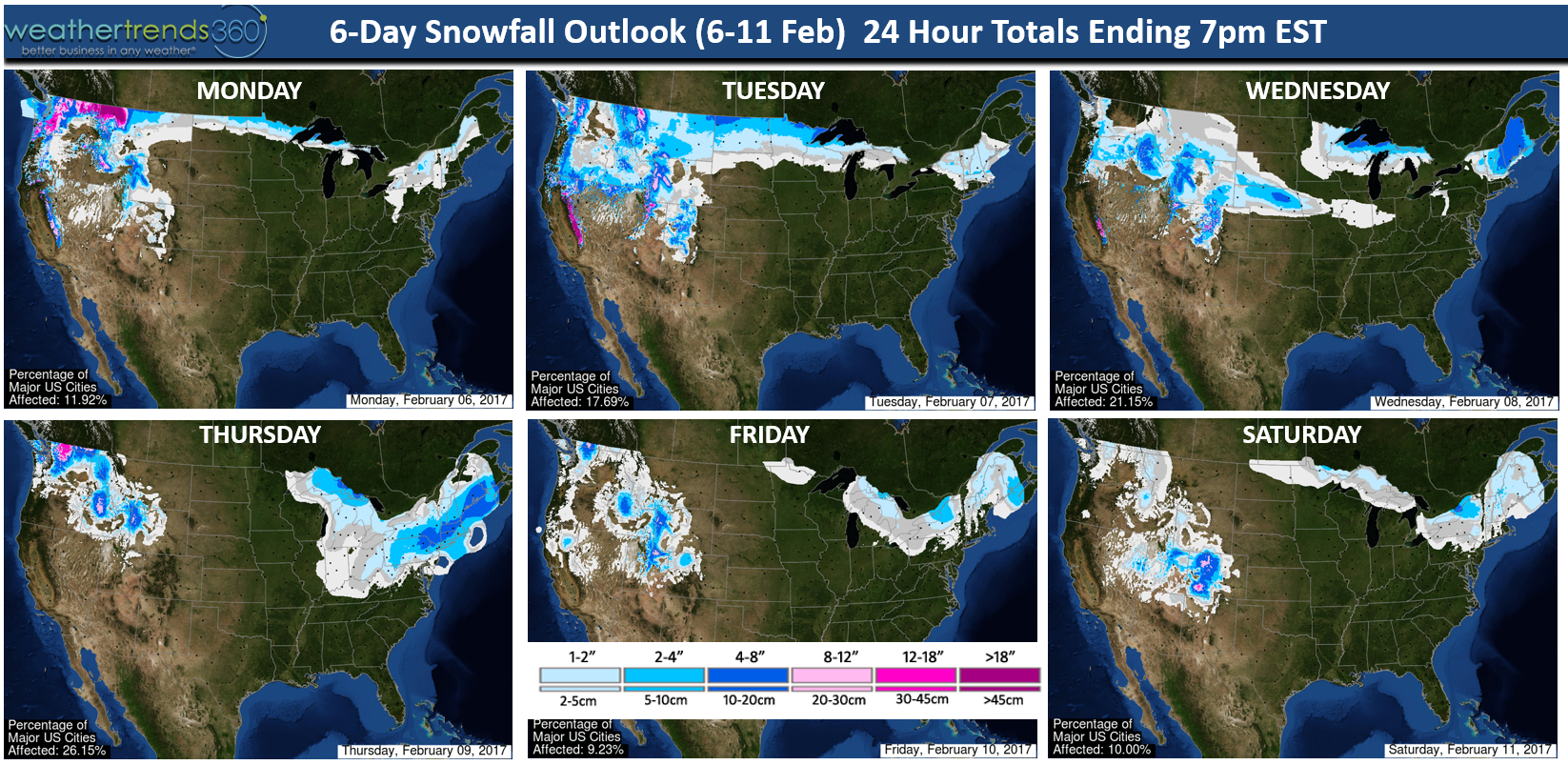
In the near term the 6-day snowfall outlook shows the risk for a light to moderate snow event for the Middle Atlantic/Southern Northeast including the Philly and NYC metro areas. This is a little different type weather event coming from the South so it has a better chance for bringing snow than recent clipper type events.
California rainfall has obviously been excessive and the next 2-weeks look to bring even more with the 2-week rainfall outlook for the state up 95% above average and a whopping 548% more than last year. This is bad news when the snow melts this spring as north central reservoirs will reach full capacity early requiring the release of excess water with downriver flooding possible.
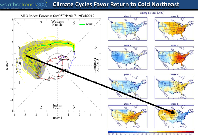
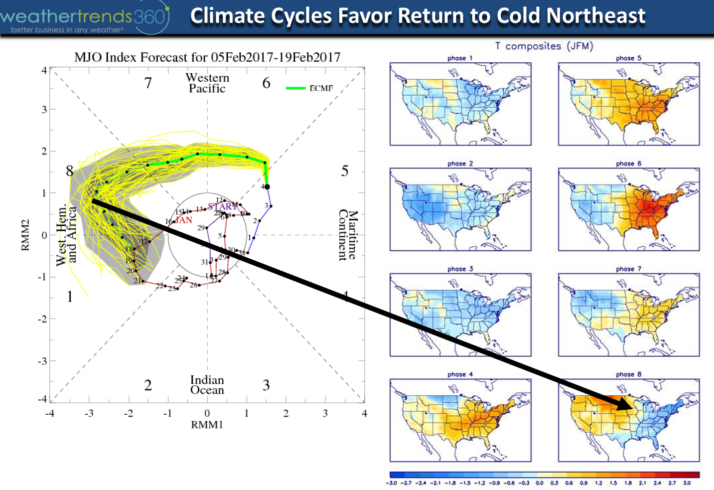
If you want a weather pattern change, you'll likely get it as we transition into the 3rd week of February as the MJO Cycle shifts into at least Phase 8, maybe Phase 1. Phase 8 is cold in the Eastern U.S. while Phase 1 is cold for much of the U.S. We also need to watch for bigger snow storms during this transition as middle to late February is historical favorable for bigger snow storms in the East. Short range models even hint at the chance for a bigger Nor'easter around the 16th-17th, way out there but the cycles suggest a more favorable pattern for East Coast snow lovers.
We hope you have a great week folks! - Capt Kirk out.
For the now the global pattern is somewhat stuck with cold air bottled up in Europe and Russia but that's likely to change late in February into March.
Global 2-week temperature trends for the period overall. Keep in mind there will be ups and downs even in the Northeast U.S.
Global 2-week precipitation trends. California remains wet as they add to their wettest winter in 19 years.
In the near term the 6-day snowfall outlook shows the risk for a light to moderate snow event for the Middle Atlantic/Southern Northeast including the Philly and NYC metro areas. This is a little different type weather event coming from the South so it has a better chance for bringing snow than recent clipper type events.
California rainfall has obviously been excessive and the next 2-weeks look to bring even more with the 2-week rainfall outlook for the state up 95% above average and a whopping 548% more than last year. This is bad news when the snow melts this spring as north central reservoirs will reach full capacity early requiring the release of excess water with downriver flooding possible.
If you want a weather pattern change, you'll likely get it as we transition into the 3rd week of February as the MJO Cycle shifts into at least Phase 8, maybe Phase 1. Phase 8 is cold in the Eastern U.S. while Phase 1 is cold for much of the U.S. We also need to watch for bigger snow storms during this transition as middle to late February is historical favorable for bigger snow storms in the East. Short range models even hint at the chance for a bigger Nor'easter around the 16th-17th, way out there but the cycles suggest a more favorable pattern for East Coast snow lovers.
We hope you have a great week folks! - Capt Kirk out.