Star Date 7 September 2017 Thursday
Captain's Log
8am EDT Update on IRMA
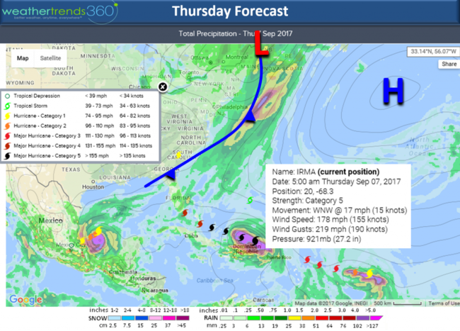
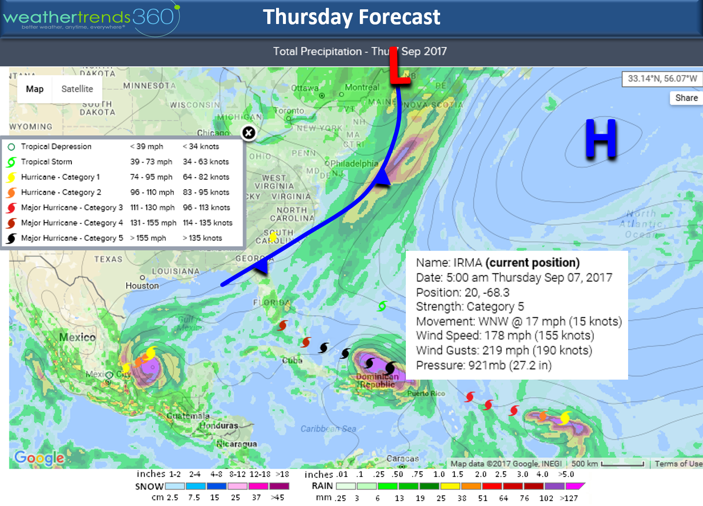
Irma remains the strongest Atlantic Basin Category 5 on record passing to the North of the Dominican Republic. Winds are sustained at 178 mph gusting to 219 mph. CLICK ON IMAGES FOR LARGER VIEW.
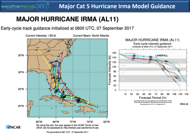
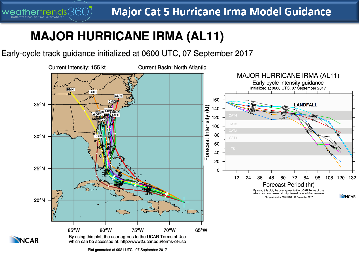
Irma will most likely maintain category 5 or strong category 4 levels as it gets very close to Miami, West Palm Beach late Saturday night - predawn Sunday. Models vary a bit with the Euro a tad more devastating to Florida with a slightly more west track through South Central and even Central Florida putting Miami to Daytona Beach in the right front quadrant of the hurricane. The US GFS is a tad farther East with the eye very near Miami and West Palm Beach with some guidance keeping the NE right front quadrant just off the Florida coast. Storm surge will be near 15 feet with 30 foot waves on top of that in the right front quadrant of the eye. The maps below show the official National Hurricane Center forecast and timing.
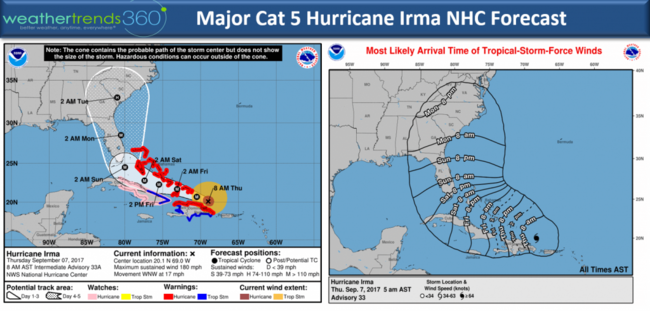
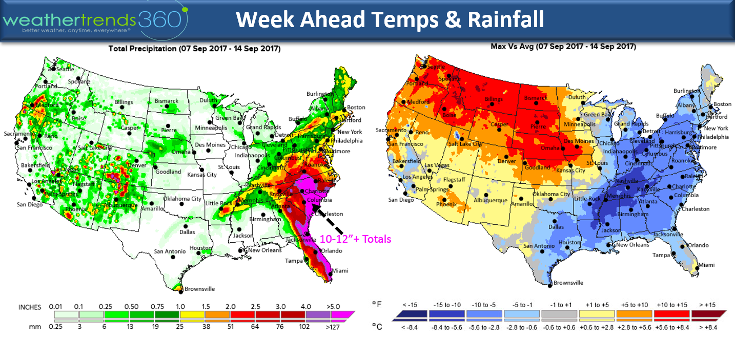
A secondary landfall looks to be in South Carolina Monday night in the general vicinity of Charleston. The most destructive part of a hurricane is the RIGHT FRONT QUADRANT and or within 15 miles of the eye in all directions.
Rainfall will not be anywhere near as bad as Harvey since the system will move rather quickly once it makes the right turn up the East Coast. Widespread 5" totals from Florida to the Carolinas with a swath of 10-12"+ likely in South Carolina.
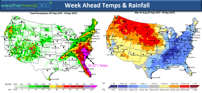
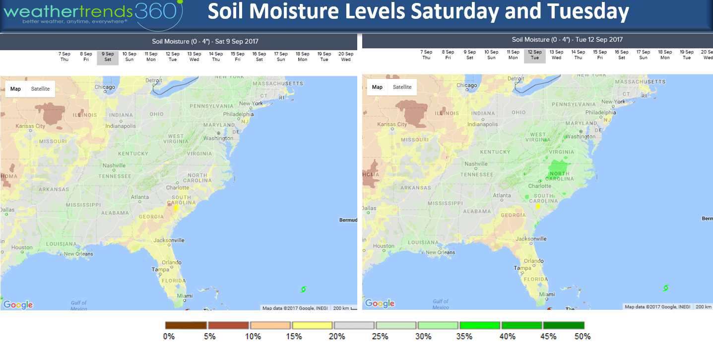
Fortunately soil moisture levels are a tad dry in South Carolina and Florida so there is some room for absorbing the rainfall. But by Tuesday the ground will be near saturated in parts of the Carolinas resulting in some flooding well inland.

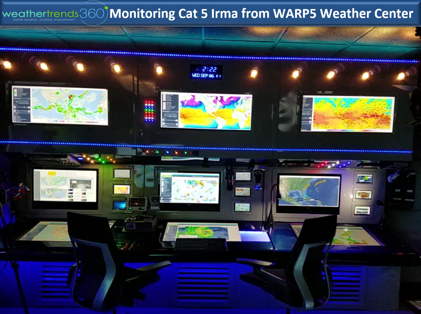
If ever you're in the Lehigh Valley of Eastern PA, be sure to stop by as you'll love our office and WARP5 Weather Center...yes it looks like a set from Star Trek. And yes we have the real Captain's Chair. :)

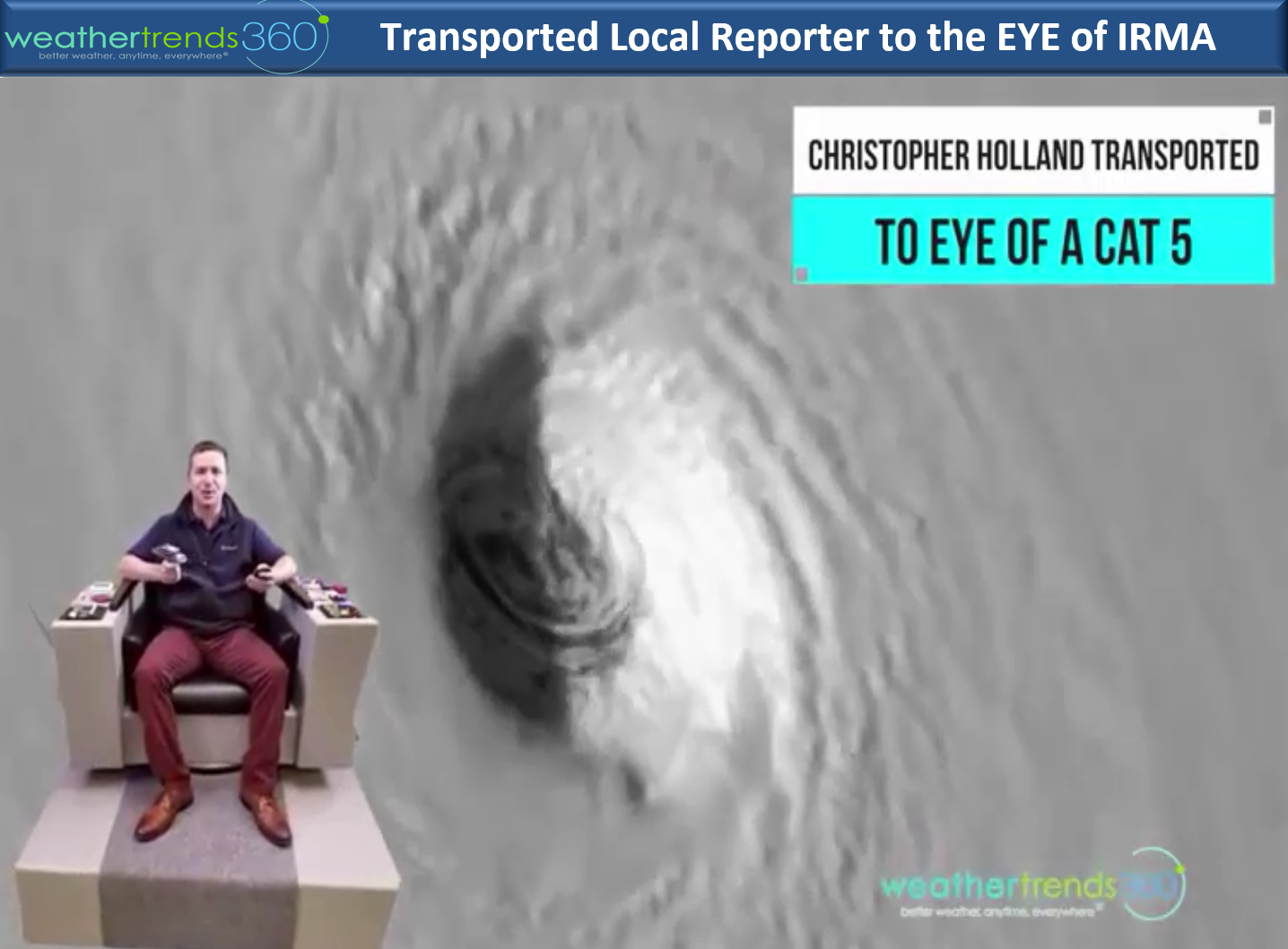
Yesterday we transported a local reporter to the eye of Irma...he was thankful we didn't leave him there.

Prayers for everyone in Irma's path...the devastation will be catastrophic within 25 miles of the eye which includes Turks & Caicos today. And oh by the way...the sun just released an X-class solar flare that is the strongest in over a decade! This could lead to widespread Auroras across the Northern Hemisphere and even well into the lower 48 states.
Kirk out.
Irma remains the strongest Atlantic Basin Category 5 on record passing to the North of the Dominican Republic. Winds are sustained at 178 mph gusting to 219 mph. CLICK ON IMAGES FOR LARGER VIEW.
Irma will most likely maintain category 5 or strong category 4 levels as it gets very close to Miami, West Palm Beach late Saturday night - predawn Sunday. Models vary a bit with the Euro a tad more devastating to Florida with a slightly more west track through South Central and even Central Florida putting Miami to Daytona Beach in the right front quadrant of the hurricane. The US GFS is a tad farther East with the eye very near Miami and West Palm Beach with some guidance keeping the NE right front quadrant just off the Florida coast. Storm surge will be near 15 feet with 30 foot waves on top of that in the right front quadrant of the eye. The maps below show the official National Hurricane Center forecast and timing.

A secondary landfall looks to be in South Carolina Monday night in the general vicinity of Charleston. The most destructive part of a hurricane is the RIGHT FRONT QUADRANT and or within 15 miles of the eye in all directions.
Rainfall will not be anywhere near as bad as Harvey since the system will move rather quickly once it makes the right turn up the East Coast. Widespread 5" totals from Florida to the Carolinas with a swath of 10-12"+ likely in South Carolina.
Fortunately soil moisture levels are a tad dry in South Carolina and Florida so there is some room for absorbing the rainfall. But by Tuesday the ground will be near saturated in parts of the Carolinas resulting in some flooding well inland.
If ever you're in the Lehigh Valley of Eastern PA, be sure to stop by as you'll love our office and WARP5 Weather Center...yes it looks like a set from Star Trek. And yes we have the real Captain's Chair. :)
Yesterday we transported a local reporter to the eye of Irma...he was thankful we didn't leave him there.
Prayers for everyone in Irma's path...the devastation will be catastrophic within 25 miles of the eye which includes Turks & Caicos today. And oh by the way...the sun just released an X-class solar flare that is the strongest in over a decade! This could lead to widespread Auroras across the Northern Hemisphere and even well into the lower 48 states.
Kirk out.