Star Date: 8 December 2017 Friday
Captain's Log
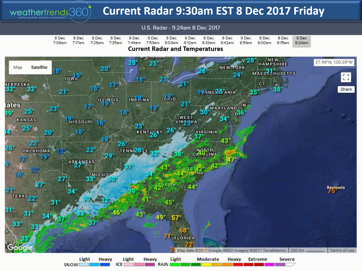
8Dec 2017 Friday Update:
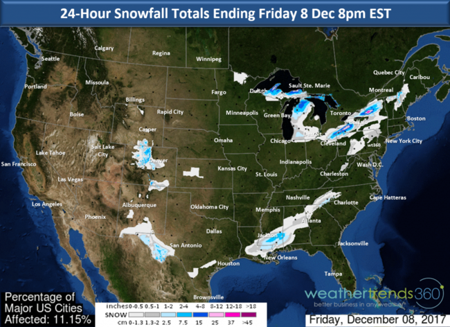
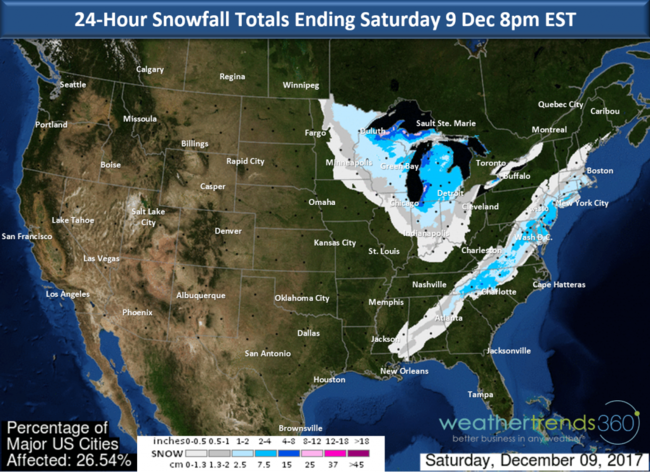
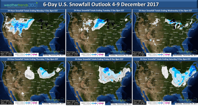
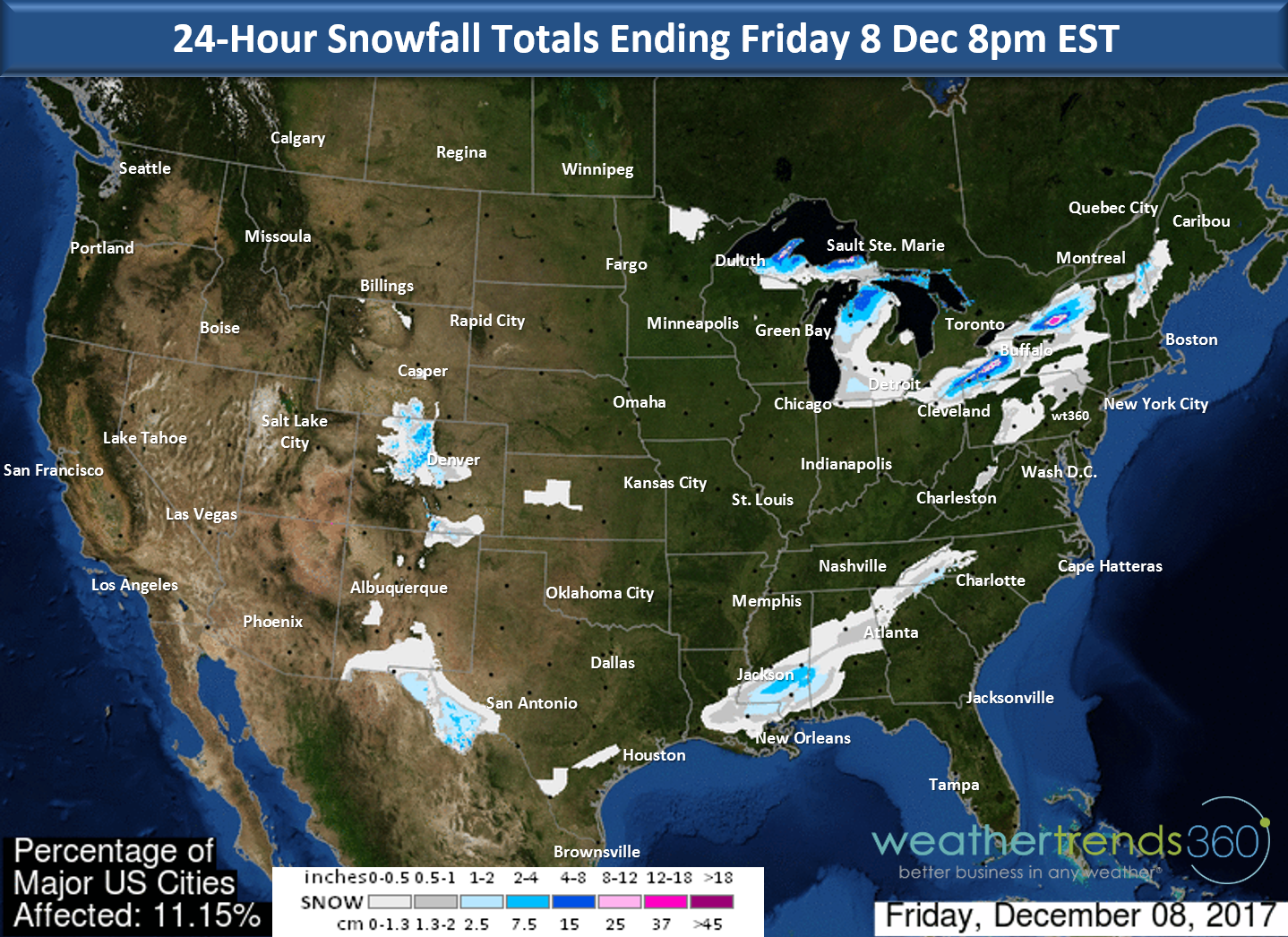
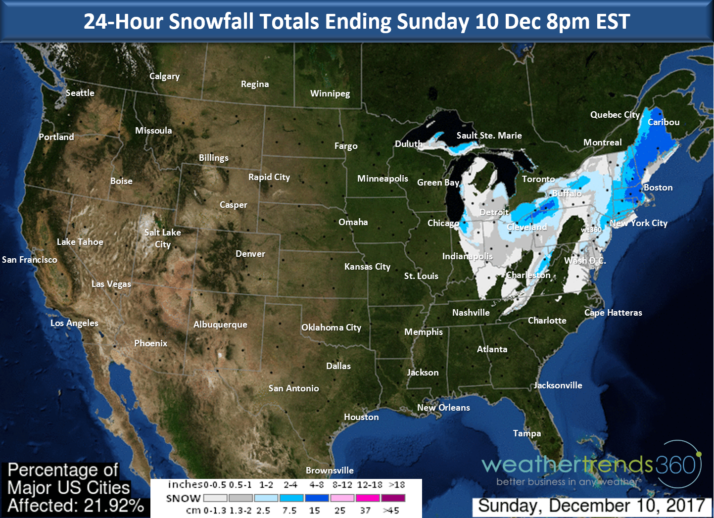
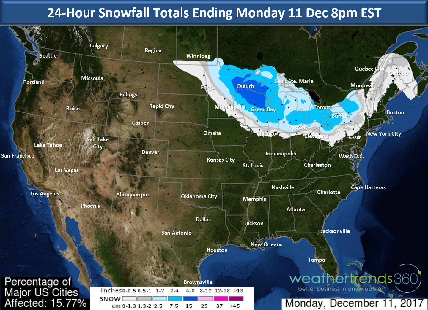
Very rare to see snow in extreme south coastal Texas in FALL let alone Winter! A narrow band of snow will fall from TX to NJ over the next 24-36 hours with the season's first moderate snow event for many in the Southeast and Coastal Northeast. After this system we'll have another Alberta Clipper type event go through the Midwest, Great Lakes and Northeast early next week so it's a snowy week ahead for the Northeast quadrant of the U.S. Have a great weekend! CLICK ON IMAGES BELOW. 6-day snowfall maps below:

FRIDAY
SATURDAY
SUNDAY

MONDAY

TUESDAY
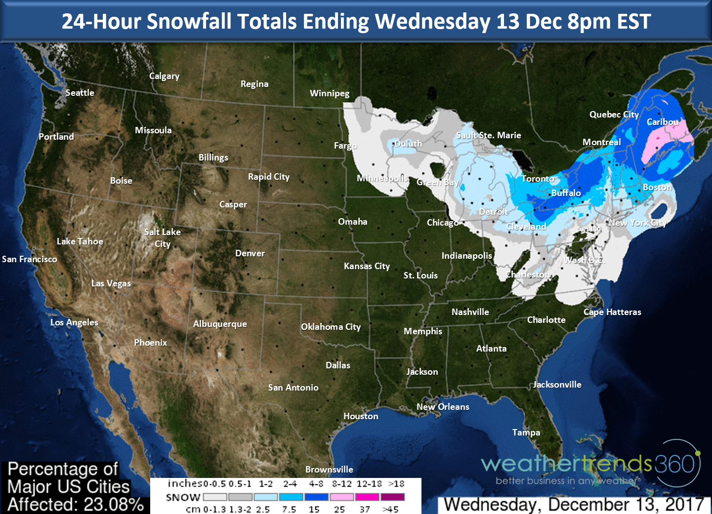
WEDNESDAY
Follow us on Facebook for daily updates.
Happy Monday! :)
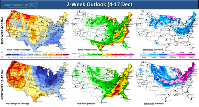
Temperature are about to plummet some 50 degrees early this week in the Eastern half of the U.S.! And YES...A LOT OF SNOW IS COMING TO THE NORTHEAST quarter of the country. Temperatures will surge in advance of this Arctic cold front into the 50s and 60s but then the bottom falls out midweek. CLICK ON IMAGES FOR LARGER VIEW.
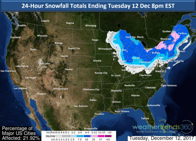
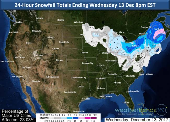
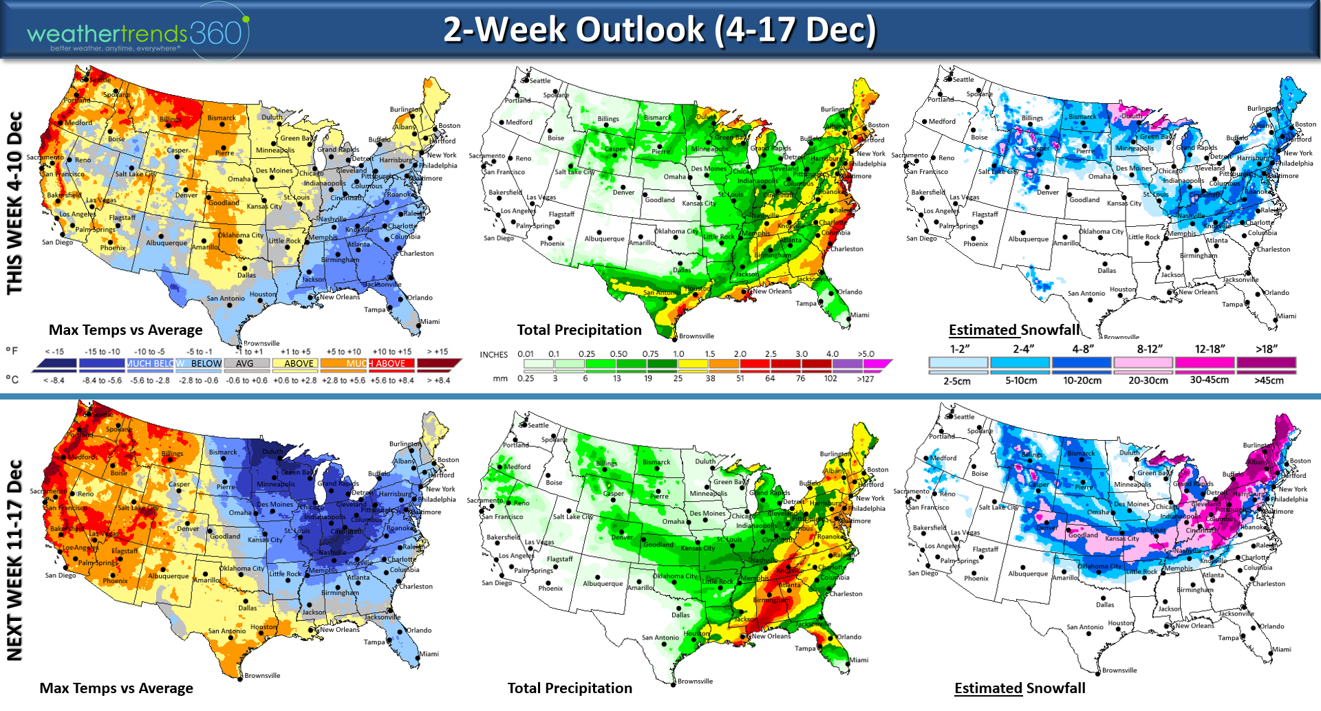
The 6-day snowfall outlook above shows the start of some lighter snows but the bigger threats in the East are just beyond this 6-day period. The U.S. GFS model is far more bullish with heavy snowfall over the next couple weeks with widespread 8"-18"+ totals, even for the big cities from DC to Boston. The Euro is a little more reasonable with widespread 4-12"+ amounts, but even the I-95 corridor will see their first accumulating snow (8-18 Dec). Hard to pin point the exact timing and intensity of all these systems as there are several clippers (lighter snows), over-running (moderate snow) and coastal events (bigger snows) to watch next week. The snow map below is just a max potential estimate. Bottom line...SNOW IS COMING to the East! With the cold in place it's very likely that many areas that get snow will hang onto it for a White Christmas in the Midwest, Great Lakes and Northeast.
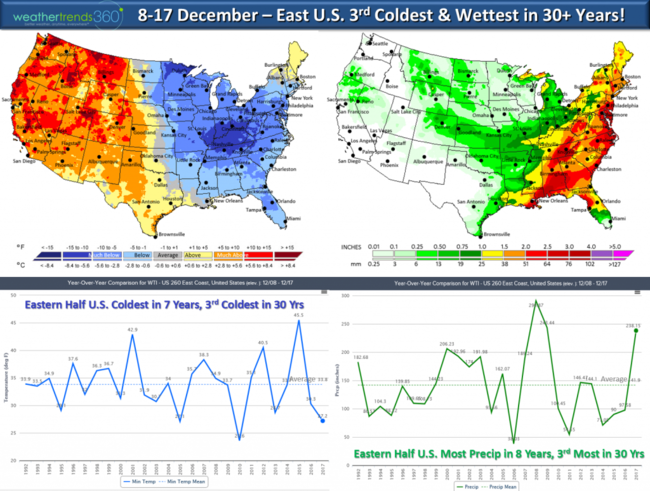
The 2nd week of December is a tale of two halves of the country with the Eastern half the 3rd coldest in 30 years, 3rd wettest in 30 years and very likely at least the 5th snowiest of the past 30 years. The West is the warm spot trending 10th warmest of the past 30 years but #1 driest.
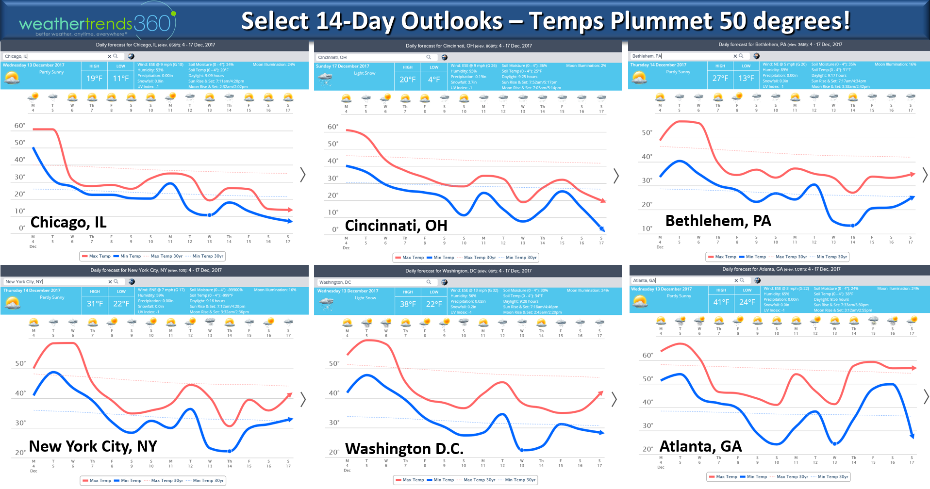
Select city forecasts show the huge plunge in temperatures for Eastern U.S. cities from the Upper Midwest to the Southeast.

The frosty sunrise this weekend near wt360 headquarters was pretty and they'll get even prettier when the snows start to fallnext week.

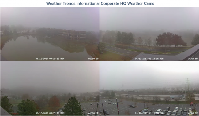
Today outside wt360 headquarters is far less pretty with ice fog as seen from the wt360 weather cams!
We hope you have a great weekand look for daily updates on wt360 Facebook and Twitter.
- Captain Kirk out.
Very rare to see snow in extreme south coastal Texas in FALL let alone Winter! A narrow band of snow will fall from TX to NJ over the next 24-36 hours with the season's first moderate snow event for many in the Southeast and Coastal Northeast. After this system we'll have another Alberta Clipper type event go through the Midwest, Great Lakes and Northeast early next week so it's a snowy week ahead for the Northeast quadrant of the U.S. Have a great weekend! CLICK ON IMAGES BELOW. 6-day snowfall maps below:
FRIDAY
SATURDAY

SUNDAY
MONDAY
TUESDAY

WEDNESDAY
Follow us on Facebook for daily updates.
Happy Monday! :)
Temperature are about to plummet some 50 degrees early this week in the Eastern half of the U.S.! And YES...A LOT OF SNOW IS COMING TO THE NORTHEAST quarter of the country. Temperatures will surge in advance of this Arctic cold front into the 50s and 60s but then the bottom falls out midweek. CLICK ON IMAGES FOR LARGER VIEW.

The 6-day snowfall outlook above shows the start of some lighter snows but the bigger threats in the East are just beyond this 6-day period. The U.S. GFS model is far more bullish with heavy snowfall over the next couple weeks with widespread 8"-18"+ totals, even for the big cities from DC to Boston. The Euro is a little more reasonable with widespread 4-12"+ amounts, but even the I-95 corridor will see their first accumulating snow (8-18 Dec). Hard to pin point the exact timing and intensity of all these systems as there are several clippers (lighter snows), over-running (moderate snow) and coastal events (bigger snows) to watch next week. The snow map below is just a max potential estimate. Bottom line...SNOW IS COMING to the East! With the cold in place it's very likely that many areas that get snow will hang onto it for a White Christmas in the Midwest, Great Lakes and Northeast.
The 2nd week of December is a tale of two halves of the country with the Eastern half the 3rd coldest in 30 years, 3rd wettest in 30 years and very likely at least the 5th snowiest of the past 30 years. The West is the warm spot trending 10th warmest of the past 30 years but #1 driest.

Select city forecasts show the huge plunge in temperatures for Eastern U.S. cities from the Upper Midwest to the Southeast.
The frosty sunrise this weekend near wt360 headquarters was pretty and they'll get even prettier when the snows start to fallnext week.

Today outside wt360 headquarters is far less pretty with ice fog as seen from the wt360 weather cams!

We hope you have a great weekand look for daily updates on wt360 Facebook and Twitter.
- Captain Kirk out.