Star Date 9 Sept 2019 Monday
Captain's Log
Still hard to say Happy Monday after all the loss of life and property with Dorian.
There are reports from Bahama officials that the loss of life may exceed 3,000. Conditions are obviously similar to what happened in 2017 when the Virgin Islands and Puerto Rico were hit so hard. CLICK ON IMAGES FOR A LARGER VIEW.
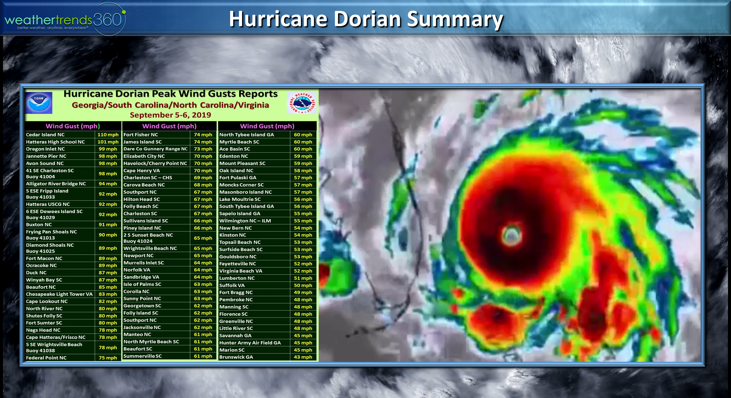
Fortunately Dorian is now in the history books after making a brief landfall on the Outer Banks of Cape Hatteras North Carolina and ultimately New Foundland Canada.
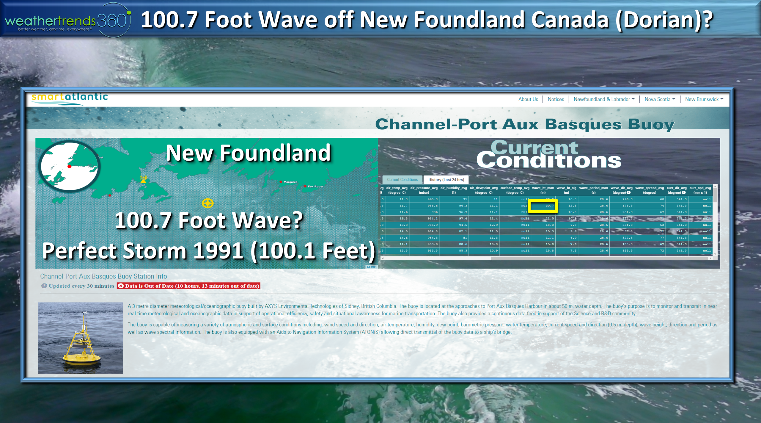
A buoy off New Foundland suggests a wave height record for the Atlantic may have been set with a wave of 100.7 feet which would break the record of 100.1 with the Perfect Storm back in 1991.
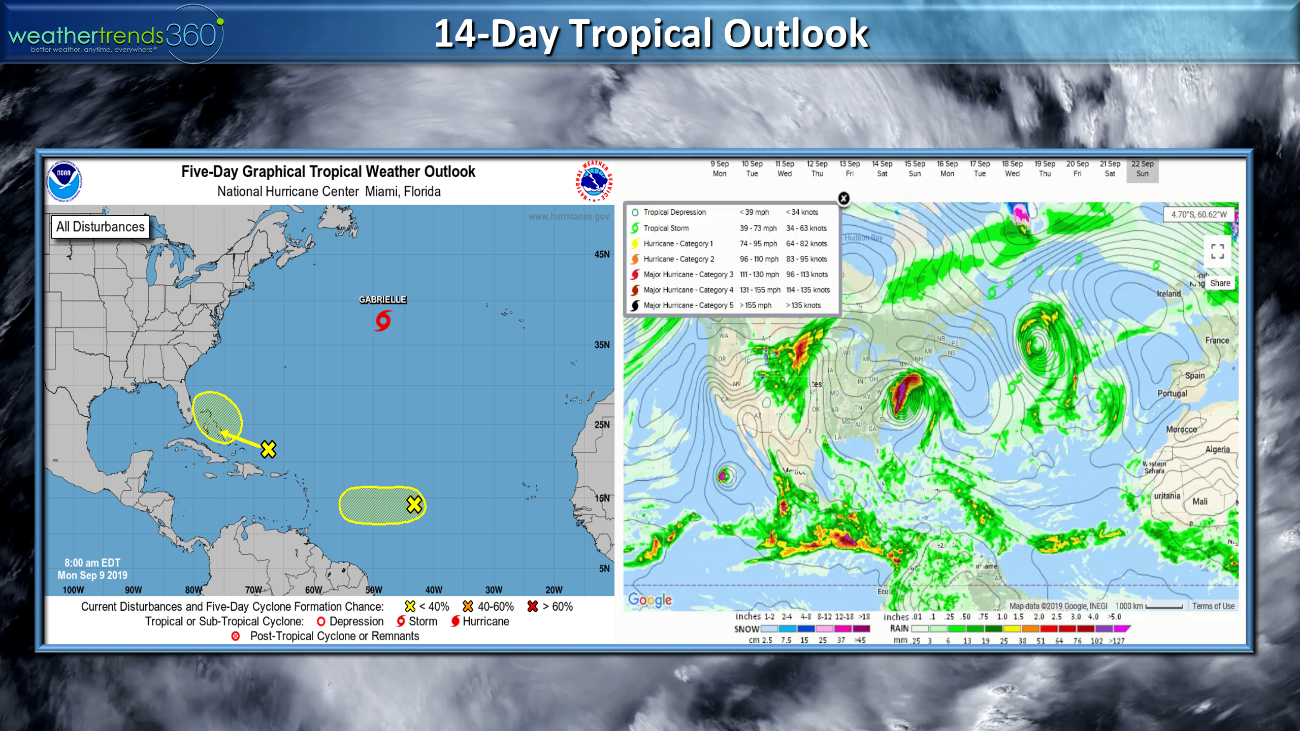
The tropics are a lot quieter now but this is the historical peak period for activity and some models try and gen up a major hurricane for the East Coast late next week. Way out there in model imagination land but something to watch as the pattern will be a tad more favorable for U.S. land falling systems.
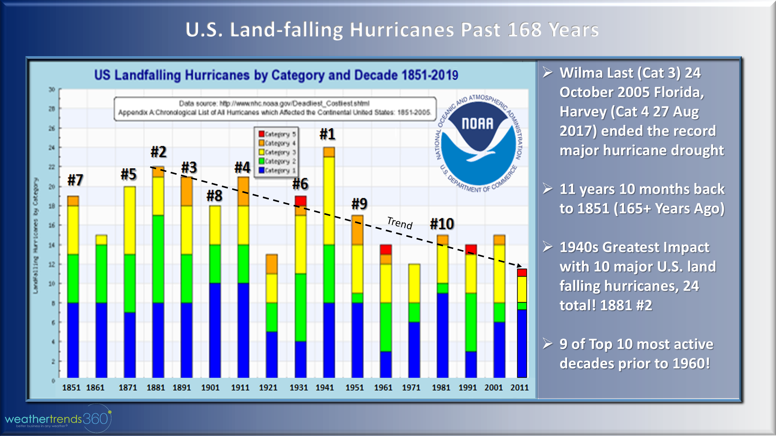
From an historical perspective we are not in a more active pattern in terms of land falling hurricanes in the U.S. as the peak was back in the 1940s so it can get a lot worse! Right now the number of land falling systems in the U.S. is near 168 year lows but has picked up the past couple years with Harvey, Florence and Michael.

The satellite era data (1970) suggests global named storms and hurricane numbers have not increased over the past 50 years.
Another measure of hurricane trends is the ACE index (Accumulated Cyclone Energy) which measure intensity and longevity and that trend is up slightly over the past 50 years but again if we went back to the peak years in the 1930 and 1940s this trend would also be down. NOAA suggests 1933 was the peak ACE year for the Atlantic Ocean, more than double the values in recent years. 1993 was the most recent peak, still below 1933.
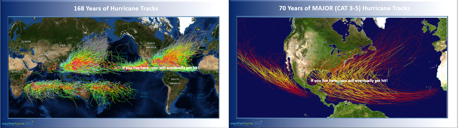
168 years of all hurricane/typhoon tracks across the world suggests you'll eventually get hit if you live in the tropics. U.S. major hurricane tracks show it's just a matter of time before locations like the Northeast U.S. are hit with a true Cat 3 or greater hurricane, Sandy was a Cat 1.
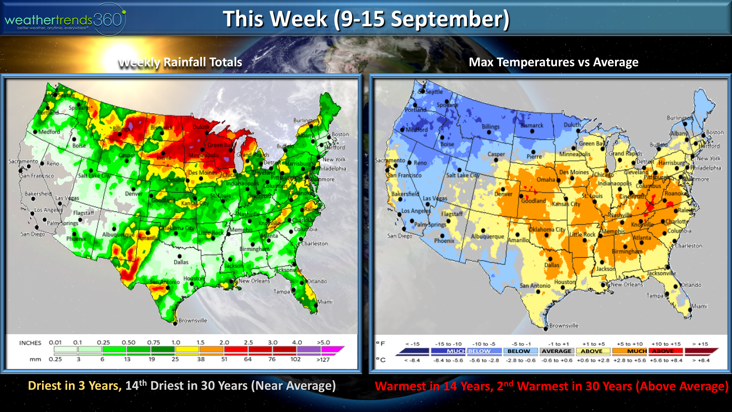
On a happier note, we're getting an extended warm start to meteorological Fall in the Eastern U.S. while the Northwest and Rocky Mountains get colder.This week (9-15 Sept) shows a warming trend after a cool weekend in the East while the Western U.S. cools down.
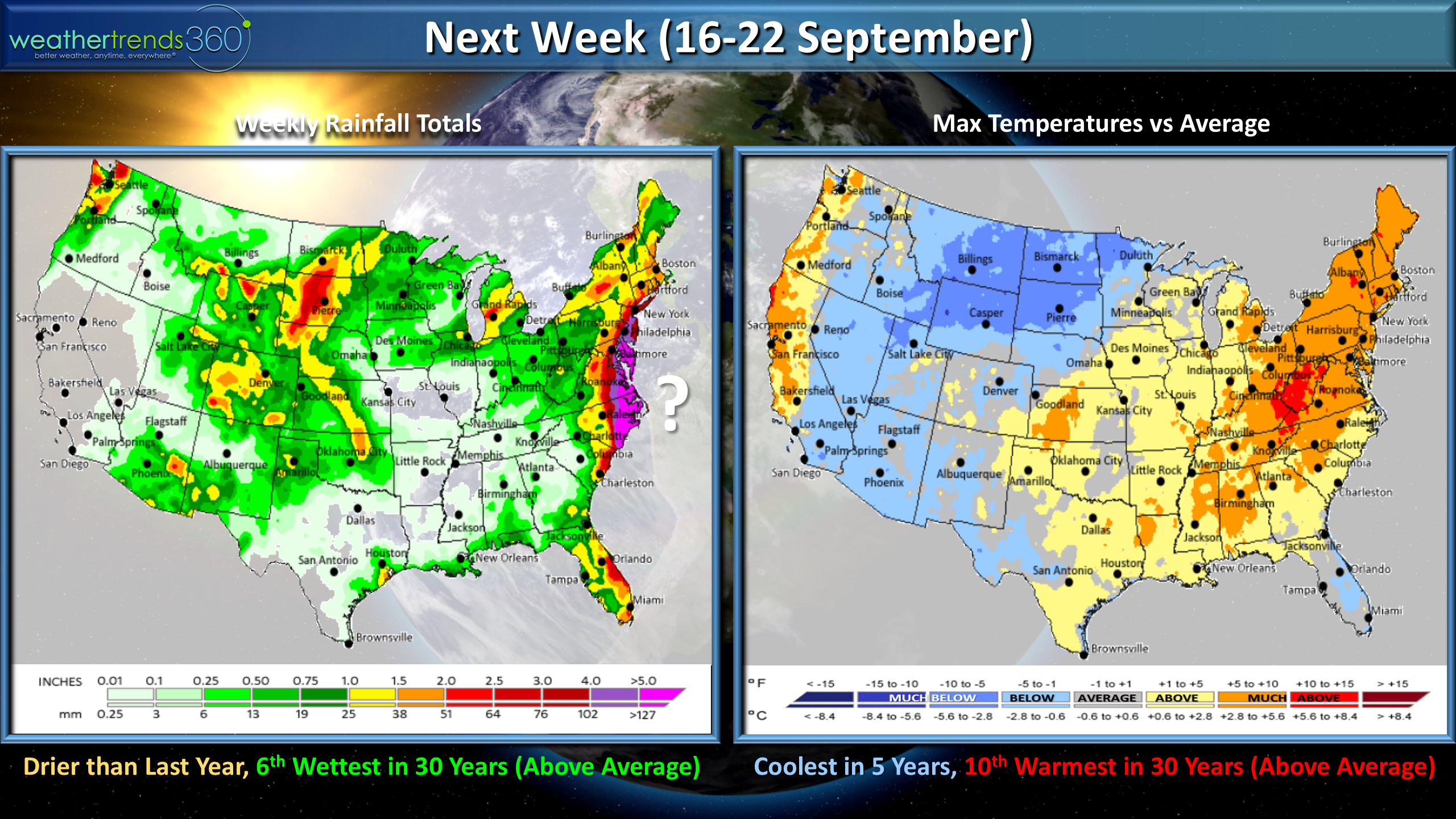
Next week (16-22 Sept) shows a risky pattern for East Coast tropical threats, so we'll need to watch the systems coming off Africa this week which take about 10 days to reach the Eastern U.S.

The 2-week world outlook shows mild weather in the U.S. although cooler than last year while it's finally warming up in Canada, very warm in Europe and hottest in 30 years down in Brazil.
Have a great week and prayers for those that lost so much with Dorian. Follow us on social media for frequent updatesFacebook,Twitter,YouTube,PinterestandLinkedin
- Captain Kirk out.